


Monte Cavallo: what to see, where to stay and eat
At a glance
- Municipality
- Monte Cavallo
- Province
- Macerata
- Region
- Le Marche
Monte Cavallo is a scattered municipality in the province of Macerata, in the Marche, on the border of the national park of the Sibillini Mountains. Its main village, Piè del Sasso, stands at an altitude of 648 m, at the mouth of a narrow gorge between rocky peaks. The territory is made up of twelve small hamlets and is among the least populated in the region. The village was once called Monsampolo. It was a fief of the Baschi of Orvieto, then of the Da Varano family and finally of the Papal States.
Those looking for travel off the busiest routes will find tall forests, mountain churches and trails starting right from the hamlets. Other villages in the area are on the page on the villages of the Sibillini Mountains.
On the map
Points from the site database. Map © OpenStreetMap contributors · Protomaps.
What to see in Monte Cavallo
The historic center has a medieval look. It is dominated by the bell tower of the parish church and the remains of the tower. The historic center, monuments and museums are only partly open to visitors, so it is worth checking before setting out.
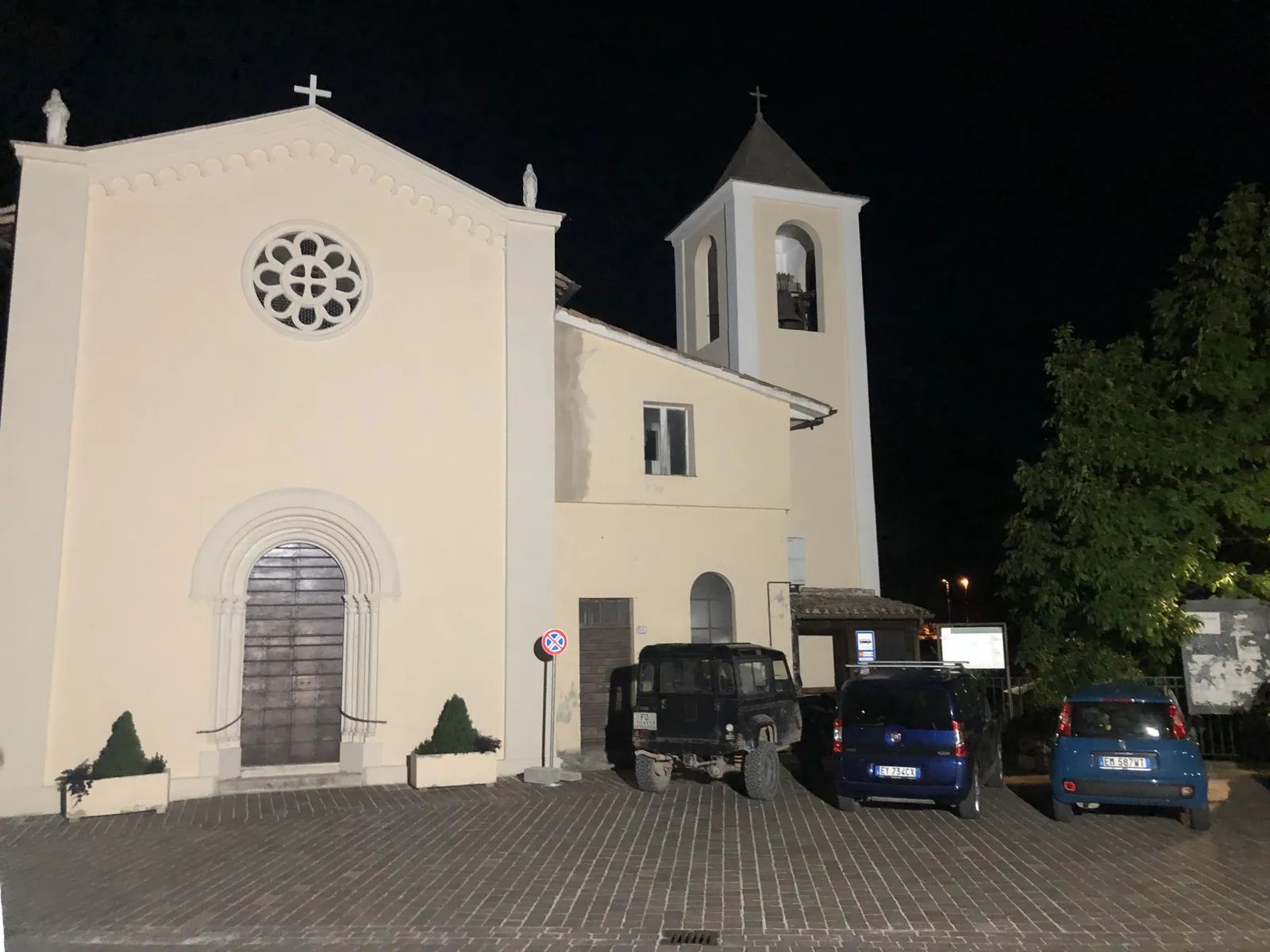
The hamlets have several churches. In Valcaldara, the church of San Nicolò has frescoes attributed to Paolo da Visso with the Annunciation, Crucifixion and Resurrection. In Selvapiana a church preserves a 15th-century cross in silver sheet. In Cerreto there are a Crucifixion and a Madonna attributed to De Magistris. In the locality of San Benedetto stands the church of San Benedetto, once a Benedictine abbey, which retains parts of its original structure. In the locality of Pian della Noce is the church of San Michele Arcangelo.
The Santuario della Madonna della Valle was rebuilt in the 1950s on the site of an older church. Around it is a public park with a picnic area with barbecues, tables and benches, an area for campers and a fitness trail with exercise equipment. Not far from the village stands the Santuario di Macereto, considered one of the finest expressions of Renaissance architecture in the Marche. An in-depth guide is on the page on things to do in Monte Cavallo.
Nature and trails near Monte Cavallo
The Bosco delle Pianotte is the best-known woodland in the municipality, with beech and yew trees, often centuries old. Between Monte Cavallo and Pieve Torina lies the Riserva Naturale Montagna di Torricchio (nature reserve), between 800 and 1,500 m altitude, made up of pastures, meadows and woods. It is managed by the University of Camerino. In Collattoni the springs called Le Vene and i Trocchi are destinations for walks. South of the main village, a valley-floor lane climbs to the small church of the Madonna della Valle, at 721 m, where a fitness trail has been set up.
For hiking, a classic route is the Collattoni–Monte Cavallo loop, a walk of a few hours. It passes Fonte i Trocchi, Colle le Cese, the ruins of the Romita, Fonte dei Marrani and Poggio Martello. Another loop starts from Pantaneto and is graded EE, for experienced hikers: it is 12.5 km long, with about 600 m of elevation gain and takes about 6 hours. It is only partly waymarked, and in the wooded stretches it can be hard to find the way. Cell phone signal is weak for much of the route. The Sentiero Italia trail also passes through Pantaneto.
The loop routes of the Ciclovia "La Porta della Sibilla" cycle route cross the area and are also suitable for mountain biking.
Local products of Monte Cavallo
The municipality is known for its cheeses. In August the Sagra del castrato e del formaggio pecorino (mutton and pecorino cheese festival) is held. Monte Cavallo is also a Città del Miele (City of Honey), with acacia, mountain wildflower, wildflower, sainfoin and forest honeydew honeys. The village's food festivals also include one dedicated to bruschetta.
Weather and how to get to Monte Cavallo
The main village is at 648 m altitude. The municipal territory ranges from 518 m at its lowest point to 1,478 m at its highest, so the climate varies a lot between the valley floor and the higher hamlets. Before a hike, it is wise to check the weather forecast.
In this section
1 result
No results with these filters.