


Monte Bove Nord: how to get there and trails
At a glance
- Type
- Peak
- Municipality
- Ussita (MC)
- Elevation
- 2,112 m
Source: site database, © OpenStreetMap contributors (ODbL).
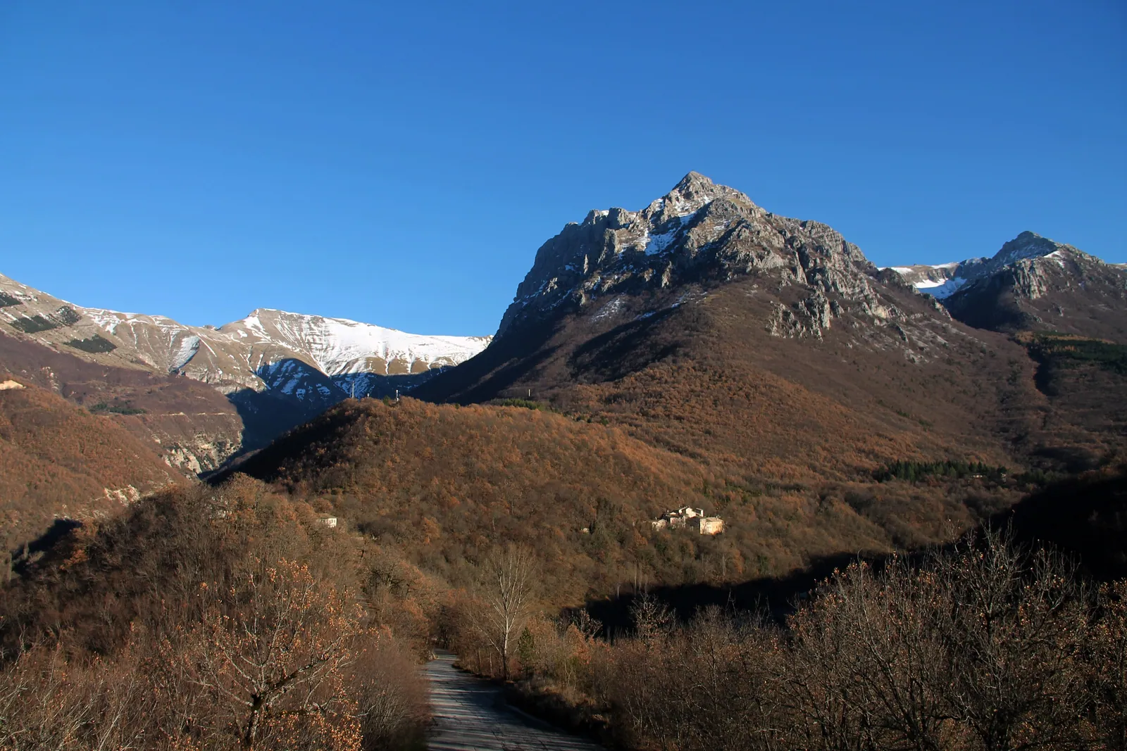
Monte Bove Nord (2,112 m) is one of the two main summits of the Bove massif. It lies in the municipality of Ussita, in the province of Macerata, in the central-northern part of the Sibillini Mountains. To the north and east the massif forms dolomitic limestone walls up to 750 m high and, overall, more than 2 km wide. The usual starting point is Frontignano, a hamlet of Ussita. The route is a hike for experienced hikers, and until December 31, 2026 the route from Frontignano is closed, even on foot, because of the construction site of the Frontignano-Cornaccione gondola lift (Comune di Ussita ordinance no. 48 of August 25, 2026). In addition, from May 1 to October 31 the trail that climbs to the summit is closed to protect the Apennine chamois.
Before you go
Forecast
- Today8° / 2°0.3 mmCloudy
Forecast by MET Norway, updated automatically · license CC BY 4.0
Rules and orders: Park website. Snow and avalanches: Meteomont bulletin.
On the map
Points from the site database. Map © OpenStreetMap contributors · Protomaps.
Where Monte Bove Nord is located
Monte Bove Nord belongs to the Bove massif, which has four main summits: Croce di Monte Bove, Monte Bove Nord, Monte Bove Sud and Monte Bicco. The Bove is bounded to the north by the gorge of the Ussita stream. To the south it faces the Vallinfante valley and connects to the Passo Cattivo. To the east it overlooks the val di Panico, to the west the Ussita valley and the village's hamlets.
Between the two main summits, the south (2,169 m) and the north (2,112 m), lies the val di Bove, of glacial origin and full of sinkholes. On the south summit stand the upper station of the old cable car and some ski lift pylons that were never used: they are the remains of an abandoned ski project.
The Bove is crossed by the fault that partly generated the Central Italy earthquake. The shocks of October 26, 2016, with their epicenter between Castelsantangelo sul Nera, Ussita and Visso, started from the fault segment that runs across this mountain.
How to get to Monte Bove Nord
Monte Bove Nord can only be reached on foot. The most used starting point is Frontignano, a hamlet of Ussita at about 1,350 m, close to Monte Cornaccione, Monte Bove and Monte Bicco. From Visso, continue toward Ussita and then climb to Frontignano. From Ussita the drive is short.
Coming from the Adriatic coast, leave the A14 at Civitanova Marche-Macerata and follow the SS77var toward Foligno as far as Muccia, then the SP209 to Visso. From Visso it is also possible to take the provincial road toward Castelsantangelo sul Nera and, just before the village, follow the signs for Frontignano at the junction. Parking is by the Frontignano cable car.
Without a car, the nearest train station is Civitanova Marche, and the hamlet is served by Contram bus lines. Check the connections in advance.
An alternative is to start from Casali di Ussita. From there the walk runs below the dolomitic face of Monte Bove Nord, with views over the Valle di Panico.
Trails and hikes on Monte Bove Nord
The Park's official route is trail E8, "Nel regno del camoscio" (In the realm of the chamois). It is 14.4 km long, with 1,230 m of elevation gain. The Park gives 5 hours and 10 minutes from Frontignano and an EE grade, for experienced hikers. The route circles the val di Bove and takes in Monte Bove Sud and Monte Bove Nord. It uses trails 257, 272, 271 bis, 271 and 270.
When the route is open, it starts from Frontignano and climbs the Prati delle Saliere to Pian dell'Arco. It then goes up Monte Cornaccione by the west ridge and continues toward Monte Bove Sud. From there a grassy ridge heading north leads to the summit of Monte Bove Nord.
The hike is not suitable for people who suffer from vertigo or have poor route-finding skills, because waymarking is missing in many stretches. The rocky ground is uneven and there are exposed spots. After the 2016 earthquake, the Park reported problems on some sections, including part of trail 272. In addition, Comune di Ussita ordinance no. 48 of August 25, 2026 bans passage, even on foot, on route E8 until December 31, 2026, for the construction site of the Frontignano-Cornaccione gondola lift. Before setting out, check the current situation with the Park.
The Bove area can only be entered on foot, not with a dog or on a mountain bike.
The north and east faces are also well known to climbers. In 1955 Alletto and Consiglio climbed the 750 m northeast arête. Climbing on the Bove is regulated by the Park.
When to visit Monte Bove Nord
Timing matters above all because of the bans. From May 1 to October 31, access to the summit trail of Monte Bove Nord is closed. In those months it is still possible to walk the ridge and admire the walls, but without going to the top.
For the Bove loop, the best period given runs from May, when there is no snow, to October. For the summit, outside the closure period, conditions are wintry. On the Bove, the gullies below the south summit freeze and are known for winter mountaineering. Before setting out, check the weather and snow conditions.
What to see near Monte Bove Nord
From the ridge the route continues to nearby Monte Bove Sud, the highest summit of the massif. The page on Monte Bove describes the group as a whole. To the south is Monte Bicco, which closes the val di Bove.
Toward the Passo Cattivo, at 1,869 m, the watershed of the range between the Frontignano grasslands and the Tenna valley, are Cima di Passo Cattivo and Cima di Vallinfante. The Tenna valley narrows toward the Gole dell'Infernaccio.
Below the north face opens the val di Panico, reachable from Casali or from Calcara. From Calcara the trail crosses the "La Bandita" wood at the foot of the rocky crag of Monte Bove Nord. Frontignano is also a ski resort. It also offers trekking, Nordic walking and mountain biking.
Frequently asked questions
Can you climb to the summit of Monte Bove Nord in summer?
How long and difficult is the route to Monte Bove Nord?
Can you go to Monte Bove Nord with a dog or on a mountain bike?
Can you see chamois on Monte Bove?
Nearby
What to see nearby
- Cascate delle CallarelleWaterfall1.3 km
- 1.3 km
- Monte BiccoPeak2.0 km
Where to stay
- Rifugio Casali, UssitaMountain hut2.2 km
- Rifugio del Fargno, BolognolaMountain hut2.4 km
- Casale Rinaldi, MontefortinoBivouac or unstaffed hut2.8 km
Where to eat
- Rifugio Saliere, UssitaRestaurant2.8 km
- Cotto e Mangiato, UssitaRestaurant2.9 km
- Schulzmania, UssitaBar and café4.3 km
Straight-line distances.