


Monte Bove: how to get there and trails
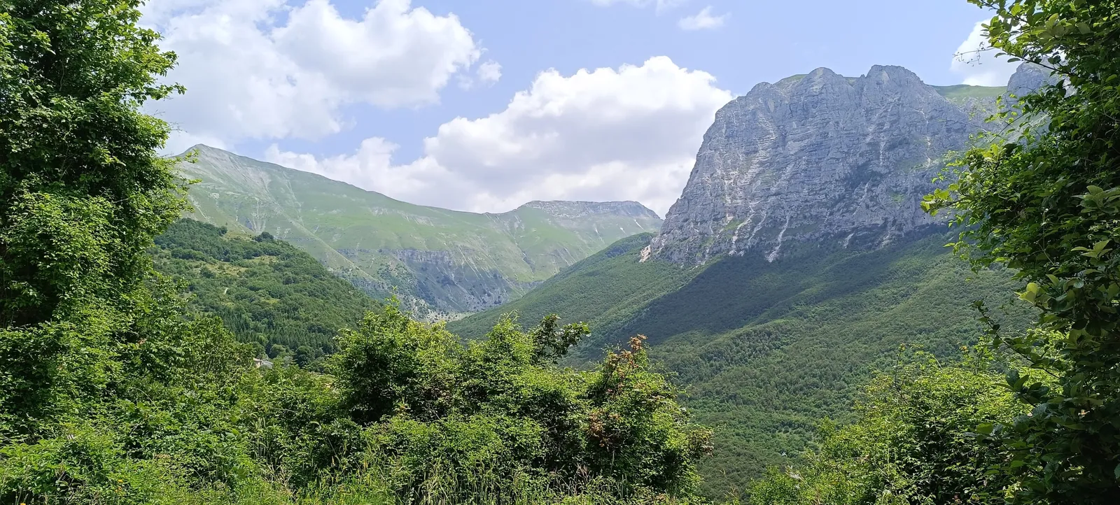
Monte Bove is the massif that towers over Ussita, in the central part of the Sibillini Mountains, in the province of Macerata. Its main summits are Monte Bove Sud, at 2,169 m, and Monte Bove Nord, at 2,112 m. To the northwest rises the Croce di Monte Bove (1,905 m), a rocky tower clearly visible from the valley: until the 2016 earthquake it carried a large metal cross, which collapsed during the shocks. Together with nearby Monte Bicco (2,052 m), these summits enclose the Val di Bove, a cirque of glacial origin full of sinkholes.
The character of Monte Bove lies in the contrast between its sides. From the Frontignano side rise grassy slopes, ski runs and old lifts. Monte Bove Nord, by contrast, drops to the Ussita valley floor in almost vertical walls. The rockiest slopes are home to the Apennine chamois, reintroduced right here and now easy to spot. The massif also bears the marks of the earthquake: the shocks on the evening of October 26, 2016 were generated by the fault segment that runs beneath Monte Bove, and landslides and collapsed walls can still be seen along the trails.
Before you go
Forecast
- Today15° / 11°0.0 mmCloudy
- Tomorrow16° / 11°3.8 mmLight showers
- Friday12° / 8°20.8 mmHeavy rain
Forecast by MET Norway, updated automatically · license CC BY 4.0
Rules and orders: Park website. Snow and avalanches: Meteomont bulletin.
On the map
Points from the site database. Map © OpenStreetMap contributors · Protomaps.
Where Monte Bove is located
Monte Bove is part of the Sibillini National Park, in the municipality of Ussita (Macerata), on the border with Castelsantangelo sul Nera. The Ussita stream bounds it to the north, the Vallinfante valley to the south. The area is also protected as the "Monte Bove" Special Area of Conservation, between Ussita and Castelsantangelo sul Nera.
The north and east sides of Monte Bove are made up of wide walls of dolomitic limestone. The north face of Monte Bove Nord is known among climbers for the historic Alletto-Consiglio route. The southwestern side, on the other hand, faces the grasslands and ski runs of Frontignano.
On top of Monte Bove Sud stands the upper station of the old Bove cable car, abandoned for years. It was part of a project for a ski area on the summit that never went into operation. The project stopped first because of technical problems, such as ice forming on the cables, and then because of the creation of the Park. Some pylons, installed for ski lifts and never used, are still standing.
How to get to Monte Bove
The climb to Monte Bove almost always starts from Frontignano di Ussita, a ski resort at the foot of the massif. Until December 31, 2026, however, the route from Frontignano is closed even on foot under ordinance no. 48 of August 25, 2026 of the Municipality of Ussita, because of the construction site of the Frontignano-Cornaccione gondola lift. Frontignano is about 10 minutes by car from Ussita, which in turn is reached via Visso.
From Umbria and Terni, take the Strada Regionale 209 della Valnerina to Visso, then follow the signs for Ussita. After the hamlet of Sasso, turn right at Fluminata for Frontignano. At the Pian della Croce junction, keep left toward the ski lifts. Beyond Pian dell'Arco, the road reaches the Fonte di Frontignano parking area, at 1,345 m, in the area where the ski lifts start.
From Perugia the route is the SS75 to Foligno, then the SS77var expressway toward Civitanova Marche as far as the Pontelatrave exit, then the SP209 to Visso. From the Adriatic coast, take the A14 to the Civitanova Marche-Macerata exit, then the SS77var toward Foligno to the Muccia exit and the SP209 to Visso. From Visso, Frontignano can also be reached on the SP134 toward Castelsantangelo sul Nera: just before the village, at a junction, there are signs for Frontignano.
Cars are left in the upper part of Frontignano, in the lift area: the Selvapiana parking area or the base of the Le Saliere chairlift. Other, less used starting points are Calcara di Ussita and Casali, on the north side of the massif.
Trails and hikes on Monte Bove
The most complete hike is the summit loop from Frontignano, which the Park marks as route E8 "Nel Regno del Camoscio" (In the realm of the chamois). It is 14.4 km long, with 1,230 m of elevation gain and about 5 hours and 10 minutes of walking starting from Frontignano. It is graded EE, for experienced hikers. The loop passes over Monte Cornaccione, Monte Bove Sud and Monte Bove Nord and returns to Frontignano. It uses trails 257, 272, 271 bis, 271 and 270, then trail 272 again, only on the section that is allowed, and trail 257.
Route E8 is currently only partly open. In addition, until December 31, 2026, ordinance no. 48 of August 25, 2026 of the Comune di Ussita bans vehicles and pedestrians from the construction site area of the Frontignano-Cornaccione gondola: the closed sections are shown on the Park's ordinance map, to be checked before setting out. The section of trail 272 that descends from Frontignano toward the Val di Bove is closed by an ordinance, because after the earthquake there is a danger of falling rocks. The section that climbs from Monte Cornaccione to Monte Bove Sud and continues toward Monte Bove Nord is also closed even on foot until December 31, 2026, under ordinance no. 48 of August 25, 2026 of the Comune di Ussita. On the ridge between Monte Bicco and Monte Bove Sud, the 2016 earthquake caused a large landslide, with fissures several meters deep. The trail runs along the southwest side of the ridge. The collapsed section should be viewed from above, without getting close.
When the route is open, the climb starts on a dirt road in the woods and then becomes steeper on the slopes of Monte Cornaccione (1,769 m). From there an almost level traverse leads to the area of the Rifugio Cristo delle Nevi (1,830 m), from where the route climbs to the ridge of Monte Bove Sud. The most common variants of the loop are between about 12 and 14 km, take from 5 to 7 hours and have elevation gains of around 900-1,100 m. They often include Monte Bicco, which offers a good view of the Frontignano ski runs.
Before setting out, it is important to know the rules that protect the Apennine chamois:
- from November 1 to April 30, the section leading to the top of the Croce di Monte Bove is closed;
- from May 1 to October 31, the trail to the summit of Monte Bove Nord is closed;
- dogs are banned throughout the area.
In every season it is possible to reach the small saddle between Monte Bove Nord and the Croce di Monte Bove. From there, looking northeast, chamois are often seen; they must not be approached or disturbed.
There are also more demanding routes from the north side. From Calcara di Ussita, a 7.2 km loop leads toward the Croce di Monte Bove, with a climbing section. From Casali, CAI trail 275 climbs the Val di Panico below the north face and reaches Monte Bove Sud. Climbing on the walls follows the Park's own rules, with permitted periods and areas. Before any outing, check with the Park authority which trails are open.
When to visit Monte Bove
Monte Bove can be visited all year round, but under rules that change with the seasons. From May to October the climb to the Croce di Monte Bove is open and the summit of Monte Bove Nord is closed. From November to April the reverse applies. For the loop from Calcara to the Croce, the best period runs from July to October.
In winter snow covers the summits, and winter mountaineering is practiced on the north face of Monte Bove Nord. Frontignano has an operating ski resort: it stayed closed for several years after the 2016 earthquake and the first lifts restarted in February 2022. The 2025-2026 season also opened, thanks to heavy snowfall on the Sibillini. In summer the Saliere chairlift and the mountain hut open on certain days, which may change depending on the weather.
The ridge hikes are long and mostly without shade. It is best to start early, check the weather and carry enough water.
What to see near Monte Bove
The Val di Bove is clearly visible from the ridges and is the most obvious sign of the massif's glacial origin. There are other summits nearby to reach on foot. Monte Bicco is easy to add to the loop. Cima di Vallinfante can be reached from Frontignano. Passo Cattivo, at 1,869 m, lies on the watershed between the Frontignano grasslands and the Tenna valley, which farther on narrows into the Gole dell'Infernaccio. Above the pass rises Cima di Passo Cattivo, where the earthquake sent part of the mountain sliding down. The full list of summits is on the page the peaks of the Sibillini Mountains.
In the municipality of Visso, on the Cupi plateau at about 1,000 meters, stands the Sanctuary of Macereto. The 2016 earthquake badly damaged it and made it unsafe to enter. In 2025, repair and seismic upgrading work was under way. Visso, a medieval village along the road to Ussita, is still dealing with reconstruction: work in the historic center began in 2025.
Frequently asked questions
When can you climb to the summit of Monte Bove Nord?
Can you bring a dog on Monte Bove?
Can you see chamois on Monte Bove?
What is the structure on top of Monte Bove Sud?
Nearby
What to see nearby
- Cascate delle CallarelleWaterfall300 m
- Monte Bove NordPeak1.3 km
- Monte RotondoPeak2.4 km
Where to stay
- Rifugio Casali, UssitaMountain hut900 m
- Rifugio del Fargno, BolognolaMountain hut2.2 km
- Camping Colorito, UssitaCampground2.3 km
Where to eat
- Cotto e Mangiato, UssitaRestaurant3.3 km
- Schulzmania, UssitaBar and café3.6 km
- Rifugio Saliere, UssitaRestaurant3.6 km
Straight-line distances.