


Gola dell'Infernaccio: how to get there and trails
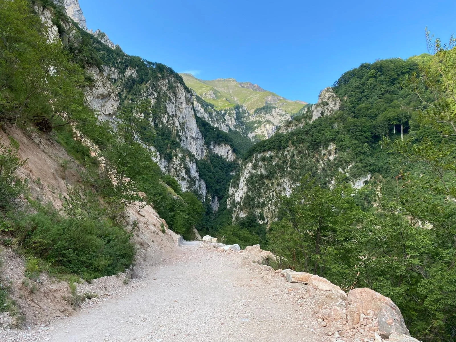
The Gola dell'Infernaccio is a narrow natural gorge carved by the Tenna river between Monte Sibilla and Monte Priora, in the territory of Montefortino, in the province of Fermo, within the national park of the Sibillini Mountains. The trail enters between vertical limestone walls and fords the stream below the Pisciarelle, small waterfalls coming down from Monte Zampa. It then leaves the gorge and climbs through the San Leonardo beech forest to the hermitage of the same name, at 1,128 meters. It is one of the most popular hikes in the Sibillini: from May to October thousands of visitors walk it, drawn also by the coolness the water brings among the rocks in the hot months.
Before setting out, it is important to know the current situation. After the winter avalanches the route stayed closed by municipal ordinance until July 17, 2026. With ordinance no. 32 of that day, the Municipality of Montefortino reopened trail E9 from the Valleria parking area to the second junction for the Hermitage of San Leonardo al Volubrio, with a mountaineering helmet mandatory. Beyond that junction the stretch toward Capotenna, where the Tenna rises, remains closed to vehicles and pedestrians by ordinance of the Municipality of Montefortino.
Before you go
Rules and orders: Park website. Snow and avalanches: Meteomont bulletin.
Where the Gola dell'Infernaccio is
The Gola dell'Infernaccio is in Le Marche, in the municipality of Montefortino (FM), in the upper Tenna valley, enclosed between Monte Sibilla and Monte Priora. The reference point for getting there is Rubbiano, a hamlet of Montefortino. Rubbiano is about 6 km from Montefortino.
The area at the foot of Monte Sibilla, between Rubbiano and the gorge, is called Valleria. According to tradition the name recalls the dances, “valli” in the local dialect, that shepherds and the Sibyl's fairies held there on full-moon nights. The oldest name of the area is Volubrio, or Golubro, interpreted as “slippery gorge” from the Latin lubricus.
In the past the gorge connected the valley of the Nera, which flows into the Tiber, with that of the Tenna, which runs down to the Adriatic. From the Rubbiano side, however, the gorge remained impassable until 1820. That year a company from San Severino built bridges and structures to bring timber down from the Mèta forest. One stretch of the gorge is still called Arcofù (“there was the arch”): oral tradition says it was once closed by a fortification with an entrance arch.
How to get to Gola dell'Infernaccio
The Gola dell'Infernaccio is reached by car as far as the Valleria parking area, then on foot. In a GPS navigator, simply enter Rubbiano di Montefortino or “parcheggio Valleria, Infernaccio.” From Montefortino and Montemonaco a paved, signposted road leads to Rubbiano. From there, follow the “Gola dell'Infernaccio” signs along a dirt cart track of about 2 km.
The dirt road is narrow: in places two cars can pass each other only with great care. There are also deep potholes, so it must be driven slowly. It ends in a pull-out closed off by concrete blocks, beyond which cars cannot go.
The Gola dell'Infernaccio parking at Valleria is not a real parking lot. Cars are left along the access road, on the left side going up; the final pull-out is only for turning around. On summer weekends and in August the spaces fill quickly, so it is best to arrive early. Latecomers park farther back and walk a few hundred meters more. Anyone with a very low car, or who feels like walking, can leave it in the signposted parking area at the entrance to the hamlet of Rubbiano.
The Valleria parking area is at 863 meters. From here an easy road descends for about 700-800 meters to the entrance of the gorge, where the Pisciarelle are. Near the barrier there is a small wooden hut used as an information point. In summer 2026 the Municipality of Montefortino, with a project funded by the Park, opened an information point in the Valleria and another in the town's public gardens. Along the access road there is also a spring for filling water bottles.
Gola dell'Infernaccio trail and hikes
The classic Gola dell'Infernaccio hike runs from the Valleria parking area to the Eremo di San Leonardo al Volubrio. The round trip is about 7-8 km, with 300-360 meters of elevation gain and 2 and a half to 3 hours of walking, excluding stops. The difficulty is low: the route suits families with children used to walking, but not strollers. The return is by the same way.
The route is trail E9. It begins with the ford below the Pisciarelle, then enters the gorge. Here the trail follows the Tenna with ups and downs among the rocks and crosses small wooden footbridges. The ground, wet from seeping water, is slippery in places. Beyond the gorge the valley widens and you reach a junction: left goes toward Capotenna, right climbs to the hermitage. The climb zigzags for about half an hour through the centuries-old San Leonardo beech forest and reaches the grassy plateau of the hermitage.
The Eremo di San Leonardo al Volubrio stands on a knoll at the foot of Monte Priora, at 1,128 meters, looking out over the walls of the gorge. A deed of donation from 1134 assigns the church of Volubrio to the hermitage of Fonte Avellana. The monastery was abandoned in the 16th century and ended up in ruins. It was rebuilt by the Capuchin friar Father Pietro Lavini: he began work on May 24, 1971 and worked on the hermitage until his death in 2015. The 2016 earthquake damaged the building: in recent years the surrounding area has been fenced off and access may be limited. In August 2026 the hermitage's drinking fountain was broken, so water must be carried up from below.
From the hermitage you can continue to the Cascata nascosta (Hidden Waterfall), also called the Cascata del Rio. The CAI-marked trail starts to the right of the fountain and is hard to see at first; it takes about another hour of walking. With this variant the full hike, round trip from the parking area, takes about 3 hours and 40 minutes. The trail to the left of the fountain is well trodden but lacks CAI waymarks.
At the junction, the other branch of the E9 follows the Tenna up to Capotenna, the river's source: beyond the second junction for San Leonardo, however, the trail is currently closed to vehicles and pedestrians by ordinance of the Municipality of Montefortino. There, after the 2016 earthquake, the Laghetto della Sibilla, a small lake, formed. Once it reopens, it is a more demanding hike: more than 11 km with over 900 meters of total ascent and landslide-prone stretches toward the source.
All routes require hiking shoes with good soles, not sneakers, and trekking poles help. Inside the gorge it is colder: even in summer, dress in layers and bring a waterproof jacket. The Municipality recommends mountain clothing and footwear and staying on the beaten trails; police checks are carried out.
Best time to visit Gola dell'Infernaccio
The Gola dell'Infernaccio is usually visited from May to fall. When the regional Protezione civile issues a weather alert, including for avalanche risk, access is banned by ordinance of the Municipality of Montefortino no. 57 of July 15, 2021. Avalanches are frequent in this area: below the Pisciarelle two plaques commemorate Lorenzo Vili and Giuseppe Cennerilli, killed by an avalanche.
Opening dates change every year. In 2026 the trail was due to reopen on May 1, but in April an ordinance closed it. Three avalanches from Monte Sibilla had buried the stretch between the parking area and the Pisciarelle and also blocked the entrance to the aqueduct tunnel. The Carabinieri forestry police stopped those who ignored the ban, in some cases with a fine. The reopening came only on July 17. Before setting out, check the ordinances in force and the weather.
Summer is the busiest season, because it is cooler between the walls of the gorge. In August and on Sundays, however, it is very crowded and the parking fills quickly. In fall the leaves of the San Leonardo beech forest change color: a good time for a quieter hike, if the ordinance allows.
What to see near the Gola dell'Infernaccio
The natural goal of the hike remains the Eremo di San Leonardo al Volubrio, but the surroundings offer more. Montefortino, the town where the road to Rubbiano starts, has a wide view of the Sibillini Mountains and the gorge. Not far away, at Montemonaco, is the Bosco dei Mazzamurelli: an easy trail populated by carved fantasy characters.
The Sanctuary of Madonna dell'Ambro, a sanctuary, is also in the territory of Montefortino. Together with the Infernaccio it is the most visited place in the province of Fermo. Father Pietro Lavini was a friar at the sanctuary before devoting himself to rebuilding the hermitage.
When the trail is open, Capotenna and the Laghetto della Sibilla are the natural continuation of the gorge. Other gorges of the Sibillini are the Gole del Fiastrone, now closed by ordinance, while the general overview is on the page on the gorges and valleys of the Sibillini.