


Monte Bove weather (high altitude)
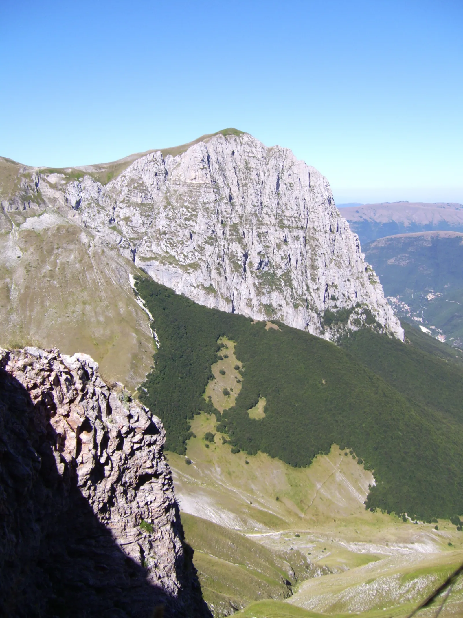
Monte Bove weather should be read according to elevation. The Monte Bove massif lies in the central part of the Sibillini Mountains, in the territory of Ussita, in the province of Macerata, and forms an almost complete ring of peaks. The highest summit is Monte Bove Sud (2,169 m), followed by Monte Bove Nord (2,112 m) and Monte Bicco (2,052 m). To the northwest rises the Croce di Monte Bove (1,905 m): its large metal cross collapsed in the 2016 earthquake.
On the north and east sides of Monte Bove there are broad faces of dolomitic limestone. At the center of the massif opens the Val di Bove, a valley of glacial origin shaped by the last ice age. It is a landscape of ridges, grasslands and cliffs where the Apennine chamois lives.
Today in Monte Bove weather (high altitude): cloudy, high 15 °C and low 11 °C, wind up to 26 km/h.
Updated: November 11, 2026 at 12:20 PM
The coming days
| Day | Sky | High / low | Rain | Max wind |
|---|---|---|---|---|
| Today 11 Nov | Cloudy | 15° / 11° | 0.0 mm | 26 km/h SW |
| Thursday 12 Nov | Light showers | 16° / 11° | 3.8 mm | 31 km/h SW |
| Friday 13 Nov | Heavy rain | 12° / 8° | 20.8 mm | 33 km/h SW |
| Saturday 14 Nov | Cloudy | 8° / 4° | 5.8 mm | 12 km/h N |
| Sunday 15 Nov | Rain | 10° / 5° | 5.6 mm | 7 km/h SW |
| Monday 16 Nov | Rain | 11° / 7° | 17.3 mm | 16 km/h SW |
| Tuesday 17 Nov | Cloudy | 12° / 8° | 1.2 mm | 17 km/h SW |
| Wednesday 18 Nov | Mostly clear | 11° / 8° | 11.9 mm | 22 km/h SW |
| Thursday 19 Nov | Rain | 10° / 7° | 8.1 mm | 23 km/h SW |
| Friday 20 Nov | Mostly clear | 10° / 6° | 0.3 mm | 28 km/h SW |
Forecast by MET Norway, updated automatically · license CC BY 4.0
Sunrise and sunset
- Sunrise
- 06:54
- Sunset
- 16:48
Calculated for this page's coordinates, Italian time.
The next 24 hours
- 1315°0.0 mm22 SW
- 1415°0.0 mm21 SW
- 1514°0.0 mm21 SW
- 1613°0.0 mm22 SW
- 1713°0.0 mm22 SW
- 1812°0.0 mm22 SW
- 1912°0.0 mm24 SW
- 2011°0.0 mm25 SW
- 2111°0.0 mm26 SW
- 2212°0.0 mm26 SW
- 2312°0.0 mm26 SW
- 0012°0.0 mm25 SW
- 0112°0.0 mm25 SW
- 0212°0.0 mm26 SW
- 0312°0.0 mm25 SW
- 0412°0.0 mm20 S
- 0512°0.0 mm18 S
- 0611°0.5 mm17 S
- 0711°0.3 mm14 S
- 0811°0.0 mm12 S
- 0912°0.0 mm13 S
- 1014°0.3 mm14 S
- 1114°0.2 mm15 S
- 1214°0.0 mm16 S
Monte Bove weather (high altitude): forecast for the coming days
The high-altitude forecast is mainly useful for anyone planning a hike along the Monte Bove ridge. The route between Monte Bicco and Monte Bove Sud stays above 1,700 meters and is exposed in places. With wind, some passages become dangerous, because it is harder to keep your balance.
In the Sibillini, valley floors are on average 2–4 °C warmer than the summits. For this reason, temperatures in the villages say little about those on the peaks. Before setting out, check the wind, the temperature at altitude and the risk of thunderstorms, and postpone the outing if the forecast is uncertain.
Monte Bove weather (high altitude): the climate month by month
On Monte Bove summers are cool and winters snowy, as on the highest elevations of the Sibillini National Park. Above 2,000 meters, average lows stay below freezing throughout the period from November to April.
Snow falls from November to April, especially between January and February. The heaviest rain and snow come in November-December and in April. Northerly and easterly currents can bring snowstorms and severe cold waves. The eastern side of the Sibillini is the most exposed to cold air from the northeast.
Summer is the least rainy season and the best for walking, but thunderstorms in these months can be very intense.
Monte Bove weather (high altitude): snow and conditions
With snow, the gullies and couloirs of Monte Bove can become very dangerous. On April 11, 2026 a large avalanche broke off the west face and swept through the Val di Bove, with a front about 500 meters wide and a kilometer and a half long. No one was injured. That day the avalanche danger in the Sibillini was "considerable", after recent snowfall, wind and a rise in temperatures.
In similar conditions, the Soccorso alpino (mountain rescue) advises avoiding gullies and couloirs such as the Val di Bove and postponing more demanding outings until the snow settles. In the snowiest winters, large cornices form on the final ridge. On the north side of Monte Bove Sud and at the head of the Val di Bove, in winter and early spring, ice and snow-filled couloirs form for mountaineering climbs such as the Torre di Luna and the Canale Y.
Before every outing on snow, check the Sibillini avalanche bulletin (bollettino valanghe). Other places are gathered on the Sibillini Mountains Weather page.