


Montefortino weather
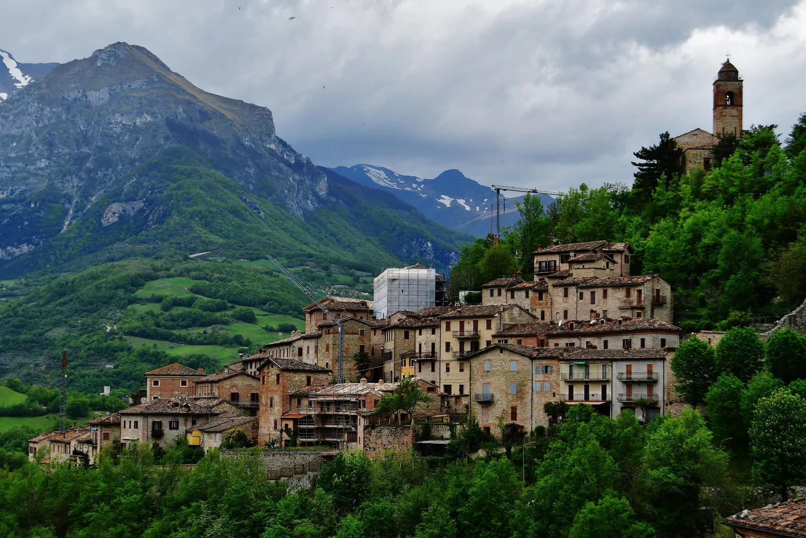
Montefortino weather depends heavily on elevation and on the mountains around the village. Montefortino, in the province of Fermo, lies at over 600 meters and spreads down the southwestern slope of a hill on the right bank of the Tenna River, facing the amphitheater of the Sibillini Mountains. From the village you can see Monte Vettore, Monte Sibilla and Monte Priora, all above 2,000 meters. Many destinations in the area lie higher than the village: the Hermitage of San Leonardo al Volubrio, a hermitage above the Gole dell'Infernaccio, is at about 1,128 meters.
Today in Montefortino: cloudy, high 17 °C and low 12 °C, wind up to 18 km/h.
Updated: November 11, 2026 at 12:21 PM
The coming days
| Day | Sky | High / low | Rain | Max wind |
|---|---|---|---|---|
| Today 11 Nov | Cloudy | 17° / 12° | 0.0 mm | 18 km/h SW |
| Thursday 12 Nov | Partly cloudy | 18° / 12° | 5.2 mm | 24 km/h SW |
| Friday 13 Nov | Heavy rain | 14° / 10° | 23.3 mm | 27 km/h SW |
| Saturday 14 Nov | Cloudy | 9° / 6° | 7.2 mm | 14 km/h NW |
| Sunday 15 Nov | Rain | 13° / 8° | 4.3 mm | 8 km/h SW |
| Monday 16 Nov | Rain | 13° / 9° | 16.2 mm | 13 km/h SW |
| Tuesday 17 Nov | Partly cloudy | 14° / 8° | 1.6 mm | 13 km/h SW |
| Wednesday 18 Nov | Partly cloudy | 12° / 9° | 10.1 mm | 17 km/h SW |
| Thursday 19 Nov | Rain | 12° / 8° | 7.1 mm | 18 km/h SW |
| Friday 20 Nov | Partly cloudy | 12° / 7° | 0.5 mm | 28 km/h SW |
Forecast by MET Norway, updated automatically · license CC BY 4.0
Sunrise and sunset
- Sunrise
- 06:53
- Sunset
- 16:47
Calculated for this page's coordinates, Italian time.
The next 24 hours
- 1317°0.0 mm16 SW
- 1417°0.0 mm17 SW
- 1516°0.0 mm18 SW
- 1615°0.0 mm17 SW
- 1714°0.0 mm16 SW
- 1813°0.0 mm16 SW
- 1913°0.0 mm17 SW
- 2013°0.0 mm17 SW
- 2112°0.0 mm18 SW
- 2212°0.0 mm18 SW
- 2312°0.0 mm18 SW
- 0013°0.0 mm18 SW
- 0113°0.0 mm19 SW
- 0213°0.0 mm19 SW
- 0313°0.0 mm17 SW
- 0413°0.0 mm14 SW
- 0513°0.0 mm12 SW
- 0613°0.4 mm11 SW
- 0712°0.7 mm9 SW
- 0812°0.0 mm11 SW
- 0914°0.0 mm12 S
- 1016°0.2 mm12 S
- 1117°0.2 mm13 S
- 1217°0.2 mm15 S
Montefortino weather: forecast for the coming days
The forecast for the coming days in Montefortino refers to the main village, at over 600 meters. For a hike toward Rubbiano, San Leonardo or, once the trail reopens, Capotenna, it is worth also checking the snow line and the freezing level, because the routes climb well above the village.
Montefortino has a station of the Marche Region's Agrometeo service. It measures minimum and maximum temperatures, humidity, precipitation and wind. Before heading into the mountains, the Municipality recommends also reading the regional Civil Protection alerts. Forecasts for nearby places are on the Amandola weather and Comunanza weather pages.
Montefortino weather: the climate month by month
Montefortino has short, warm summers and long, cold winters. The figures below are approximate averages.
From mid-November to mid-March average highs stay below 10 °C. In January and February average lows approach 0 °C.
In spring precipitation increases. April is on average the rainiest month, out of a total of about 1,100 mm a year of rain and snow.
July and August are the hottest months, with average highs of 26-28 °C and lows around 16 °C. For outdoor activities in warm weather, the best period runs from mid-June to early September. In September average highs drop to around 23 °C and lows to 13 °C, with about 11 days of rain.
Montefortino weather: snow and conditions at the Gola dell'Infernaccio
Around Montefortino there are snowshoe outings at mid elevations, but snow is not guaranteed. The Sentiero Natura di Rubbiano is a loop of about 5 km that starts and ends at Rubbiano (834 m). It has 200 m of elevation gain, takes 2 hours to 2 hours 30 minutes of walking (2 to 2:30 h) excluding stops, and is of moderate difficulty. Because of the low elevation it does not always have snow. With heavy snow, the red-and-white flags with the letter "N" can end up buried.
Gola dell'Infernaccio weather matters in winter: at the Gole dell'Infernaccio, after a major snowfall, access can stay closed or impassable for days. In winter there is no snow clearing or maintenance, and winter tires or snow chains may be needed on the road. Avalanches also affect the following season. In 2026 the gorge stayed closed because of damage from winter avalanches until Ordinance no. 32 of July 17, which reopened the trail as far as the second junction for San Leonardo, and the trail beyond the second junction for San Leonardo toward Capotenna remains closed to vehicles and pedestrians under an ordinance of the Comune di Montefortino. Before an outing on snow, read the Sibillini avalanche bulletin (bollettino valanghe).