


Monte Vettore: How to Get There and Trails
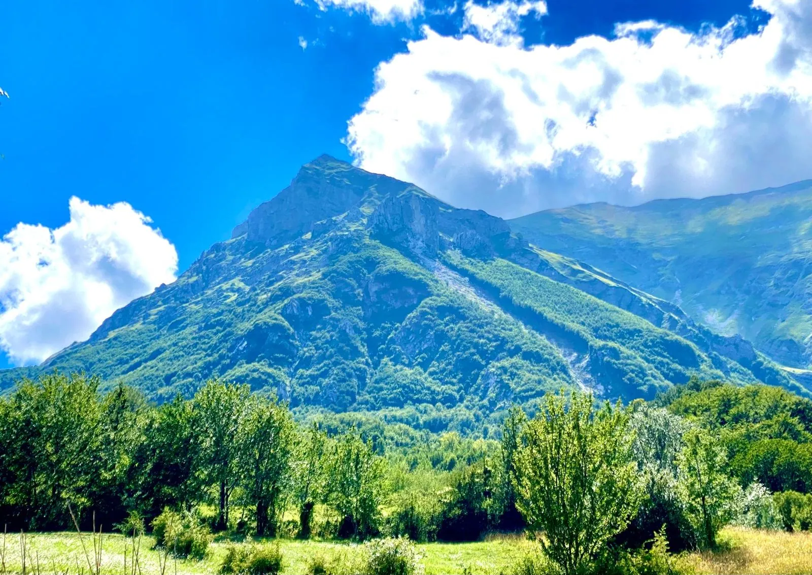
At 2,476 meters, Monte Vettore is the highest peak of the Sibillini Mountains and the tallest, most recognizable mountain between Umbria and the Marche. The name comes from the Latin "victor", meaning winner, because the Vettore rises above all the other mountains in the Sibillini range. On clear days the view from the summit takes in central Italy. The Monti della Laga and the Gran Sasso appear to the southeast, the Terminillo to the southwest and the Marche coast all the way to the Adriatic. When the air is at its clearest, the Velino, the Maiella and, on the Tyrrhenian side, Monte Amiata come into view too. At the foot of the face of Pizzo del Diavolo lies Lago di Pilato, at 1,941 meters, the only natural lake in the Marche.
The Vettore also bears the marks of the earthquake. The 2016-2017 Central Italy seismic sequence began with the reactivation of the Vettore-Bove fault system. On the side of the mountain, the Cordone del Vettore is a fault scarp that tradition calls the "Sentiero delle Fate" (Fairies' Path), and it was reactivated by the 2016 earthquake. The most popular Monte Vettore hike starts from the Forca di Presta pass on trail 101. The elevation gain is about 940 meters, the difficulty is graded as hiking, and there are no water points along the way.
Before you go
Forecast
- Today13° / 8°0.0 mmCloudy
- Tomorrow14° / 8°5.8 mmLight rain
- Friday11° / 6°25.4 mmHeavy rain
Forecast by MET Norway, updated automatically · license CC BY 4.0
Rules and orders: Park website. Snow and avalanches: Meteomont bulletin.
On the map
Points from the site database. Map © OpenStreetMap contributors · Protomaps.
Where Monte Vettore Is
Monte Vettore lies in the Umbria-Marche Apennines, on the border between Umbria and the Marche, inside the Sibillini National Park.
The Vettore group has three sides, each in a different municipality: the western side belongs to Norcia, in Umbria, the southern side to Arquata del Tronto and the eastern side to Montegallo, in the Marche. Seen from above, the massif is shaped like a "U". From west to east it includes Quarto San Lorenzo, Cima del Redentore (2,448 m) with the spur of Pizzo del Diavolo (2,410 m), Cima del Lago (2,422 m), Monte Vettoretto, the Vettore and Monte Torrone (2,117 m). The northwest ridge connects to the other Sibillini peaks and marks the watershed between the Tyrrhenian and the Adriatic. To the north, the Valle dell'Aso separates the group from the rest of the range. In the middle of the "U", in a glacial cirque at the foot of the summit, lies Lago di Pilato.
Geologically, the Vettore is a limestone massif of the Umbria-Marche sequence. The exposed rocks date mainly from the Jurassic and hold many fossils of ammonites and gastropods. The north faces were shaped by the Quaternary glaciations. To the west, faults gave rise to depressions such as the Piani di Castelluccio.
How to Get to Monte Vettore
The climb up Monte Vettore usually starts from the Forca di Presta pass, at 1,536 meters in the municipality of Arquata del Tronto. The pass can only be reached by car or other private vehicle, because no regular public transport line serves it. Forca di Presta is reached from Pretare, from Castelluccio di Norcia or from Balzo di Montegallo, along the provincial road that links the Marche side of the Sibillini with the Umbrian side.
From the Marche, start from Ascoli Piceno (about 40 km from the pass) and follow the state road 4 Salaria toward Rome, past Acquasanta Terme. At the hamlet of Trisungo, leave the Salaria and climb toward Borgo di Arquata, then through Piedilama and Pretare. After about 6 km there is a fork on the left leading to Forca di Presta: this is the most scenic stretch, about 7 km long. By car, Arquata is about 20 minutes from the pass.
From Umbria, drive up from Norcia to the Piani di Castelluccio: it is about 28 km, around forty minutes. Then cross the plain and climb back up to Forca di Presta, about 10 minutes by car from Castelluccio. In all, getting from Norcia to the pass takes about fifty minutes.
The east side is reached from Colle di Montegallo, a hamlet near Balzo di Montegallo (about 30 km from Ascoli). From Colle, walk up to the church of Santa Maria in Pantano.
In winter, snow and ice rule at Forca di Presta. The road may stay closed for a few hours or for days, or it may require winter tires or chains on board.
Monte Vettore Trails and Hikes
Two hiking trails lead to the summit of Monte Vettore: trail 101, which starts from Forca di Presta, and trail 131, which starts from the church of Santa Maria in Pantano, near Colle di Montegallo.
Trail 101 from Forca di Presta. This is the shortest and most popular Monte Vettore trail. Trail 101 starts right opposite the road junction at the pass and climbs the Vettoretto ridge, with views of the Castelluccio plain. On the way up it passes the cross dedicated to Tito Zilioli, the mountaineer from Ascoli who died on the Vettore on March 30, 1958. The Tito Zilioli bivouac hut, on the Sella delle Ciaule saddle, is reached after more than 700 meters of elevation gain over about 4 km. From there, only the last stretch of the climb to the summit remains. In short:
- elevation gain: about 940 m;
- round-trip length: about 10 km;
- time: 2 and a half to 3 hours up, about 5 hours round trip, not counting stops;
- difficulty: E (hiking).
Trail 101 has no trees or springs and is always in the sun. Some sections are very steep and slippery, and the weather on the Vettore can change quickly. Hiking shoes and a good supply of water are therefore needed.
The old stone hut, built in 1960, was damaged by the 2016 earthquake. On the same spot, at about 2,240 meters, a new bivouac hut owned by the Ascoli Piceno section of CAI (the Italian Alpine Club) was opened in August 2021. The only service is electricity from solar panels: there is no running water and there are no toilets. The bivouac has two rooms: an emergency room, always accessible, and a locked one that only CAI members can book.
Trail 131 from Santa Maria in Pantano. This is a longer, more demanding route on the eastern side. From Colle, walk up to the church of Santa Maria in Pantano, which largely collapsed in the 2016 earthquake, and continue to the Fonte del Pastore spring, at about 1,525 meters. The trail then crosses the whole east-northeast face of the Vettore, passes below the Sassone and reaches the ridge. The hike is about 15.5 km long, with a big elevation gain, and takes 7-8 hours of walking. It is graded EE, meaning for expert hikers. In snow, the traverses near the Sassone and the Grande Imbuto gully require care and preparation. From the ridge a loop is possible: toward Il Pizzo or, on trail 132, along the ridge of Sasso d'Andrè and Monte Torrone.
Mountaineering. The great southeast face of the Vettore also draws climbers. The first route, the Marsili-Trentini-Cicchetti, dates from 1928 (1,000 m, III+). Later the even more direct Bachetti-Spinelli was opened (1,000 m, III). On the Scoglio dell'Aquila there is the classic Florio-Capponi, along the southeast arête (200 m, IV).
Best Time to Visit Monte Vettore
Monte Vettore is visited all year round, but each season changes the kind of experience and the difficulties. Trail 101 can be walked in every season. In summer it is best to start in the cool morning hours, because the route never has any shade.
In winter, snow and ice can close the road to Forca di Presta. The routes on the southeast face become very demanding climbs, worthwhile in the cold season too. With the arrival of spring, in May, the snow starts to melt and Lago di Pilato fills up again. If it is still cold, though, crampons and an ice axe may be needed to approach the lake.
Since the 2016 earthquake, some trails and access points, especially toward Lago di Pilato, have been governed by ordinances that may change. Before setting out, check the state of the trails and the road on the channels of the Sibillini National Park, the Municipality of Arquata del Tronto and CAI, and look at the weather forecast.
What to See Near Monte Vettore
Lago di Pilato. Lago di Pilato (Lake Pilato) lies at 1,941 meters, at the head of the Valle dell'Aso, below the face of Pizzo del Diavolo. It is a small lake of glacial origin, fed mainly by melting snow, and it is no more than 400 meters across. It is home to an animal found only in this lake: the Marchesoni's fairy shrimp (chirocefalo del Marchesoni), a small reddish crustacean 9-12 mm long. A legend says that the body of Pontius Pilate ended up in the lake. Between the Middle Ages and the Renaissance the lake drew necromancers. The detour that drops steeply toward the lake starts from the Zilioli bivouac, with about 300 meters of elevation change. Strict rules apply in the valley: it is not permitted to approach the lake, and dogs, bicycles, drones and fires are banned.
The Cordone del Vettore and the legend of the fairies. The Cordone del Vettore is a transverse band of bare rock and gravel. According to legend, it was dug by the fairies of the mountain, perhaps in the service of the sorceress Sibyl. After dancing too long with the young men of Pretare, they are said to have fled at dawn, digging the path with their goat hooves. In Pretare, a hamlet of Arquata del Tronto, the legend is re-enacted on the feast of San Rocco: a group of girls dressed as fairies arrives in the square and opens the dancing.
The Castelluccio plateau. To the west the view is dominated by Cima del Redentore, which looks out over the Castelluccio di Norcia plateau, known for its lentils and its blooms.
Santa Maria in Pantano. Santa Maria in Pantano is a Romanesque church at the foot of the Vettore that belonged to the Farfa monks of Santa Vittoria in Matenano. It stood along the old Sentiero dei Mietitori (Reapers' Path), which went around the Vettore as far as the Castelluccio plain. The church largely collapsed in the 2016 earthquake; in 2025 the repair work was approved.
The other peaks of the group. From the Vettore there are close-up views of Cima del Lago, Pizzo del Diavolo and Il Pizzo. Other routes are collected on the page about the Sibillini Mountains peaks.
Frequently asked questions
Where is Monte Vettore?
How high is Monte Vettore?
What is Monte Vettore?
Where can you stay overnight near Monte Vettore?
How do you get to Monte Vettore, and where does the hike start?
Which rivers rise here?
When is the best time to visit Monte Vettore?
How long is the Monte Vettore hike on trail 101?
What does Vettore mean in Italian?
Nearby
What to see nearby
- Lago di PilatoLake800 m
- Il PizzoPeak900 m
- 1.4 km
Where to stay
- Bivacco Tito Zilioli, Arquata del TrontoBivouac or unstaffed hut900 m
- AgriMusicismo B&B&B, MontegalloCampground3.1 km
- Casa delle Fate, MontegalloTourist accommodation3.2 km
Where to eat
- Adrenalina, MontegalloClimbing1.5 km
- 3.0 km
- Classe 62, MontemonacoClimbing3.0 km
Straight-line distances.