


Arquata del Tronto: what to see and do
At a glance
- Municipality
- Arquata del Tronto
- Province
- Ascoli Piceno
- Region
- Le Marche
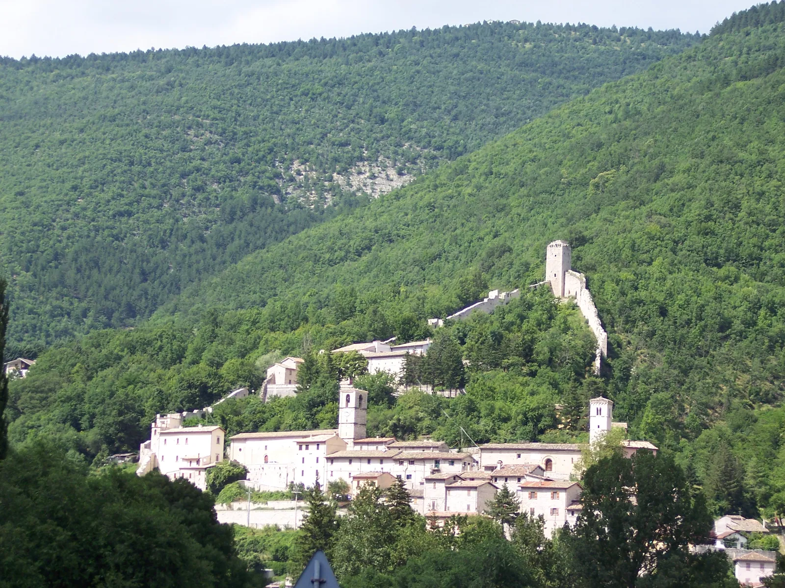
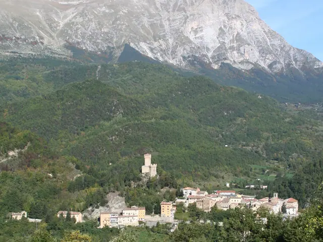
Arquata del Tronto is the municipality at the far southwestern tip of Le Marche. Its territory, about 92 km² in the province of Ascoli Piceno, borders Lazio, Umbria and Abruzzo and is the only one in Europe lying within two protected areas: the Sibillini Mountains National Park to the north and the Gran Sasso and Monti della Laga National Park to the south. The main town stands at 777 meters, on a rise in the upper Tronto valley, between the river and the Fosso di Camartina stream. Above the town is the medieval Rocca (fortress). Within the municipal boundaries, altitudes range from 580 meters on the valley floor to 2,476 meters at Monte Vettore. The landscape shifts from rock walls to forests of chestnut, beech and conifers, up to the high pastures. From the highest peaks the Gran Sasso and the Adriatic Sea are visible.
This has been a land of passage for two thousand years. The Roman Via Salaria ran through here, leading from Rome down the Tronto valley to the Adriatic. Some scholars identify Arquata with the staging post of Surpicanum, which appears on the Tabula Peutingeriana. On the so-called "magic side" of the Sibillini, ancient paths climbed toward the Strada delle Fate (Fairies' Road), the Grotta della Sibilla (Sibyl's Cave) and Lago di Pilato. The 2016 earthquake struck the municipality with extreme severity: the shock of August 24 caused 52 deaths in the municipality, 48 of them in the hamlet of Pescara del Tronto. Ten years on, reconstruction is under way. At the end of August 2026 work was handed over to consolidate the hill on which the main town stands, an essential step before rebuilding the buildings of the historic center.
On the map
Points from the site database. Map © OpenStreetMap contributors · Protomaps.
What to see in Arquata del Tronto
Today Arquata del Tronto is a territory being rebuilt. There is the Rocca, the 13th-century crucifix kept in a new church and the hamlets linked to the legends of the Sibyl. Before setting off, keep in mind that several monuments are closed or under restoration.
The Rocca di Arquata is a medieval fortress built to control the territory. It rises on a crag north of the town and watches over the upper Tronto valley and the Salaria. The complex consists of a partly preserved circuit of walls, two towers and the remains of a third tower, of which only the foundations show. According to tradition, Queen Giovanna promoted the rebuilding of the fortress, which is therefore also called the "Castello della Regina Giovanna" (Queen Giovanna's Castle). The Rocca withstood the shocks of August 24 and October 30, 2016, but suffered serious damage and is closed for restoration. In July 2026 the final design for the work was approved, which also includes seismic upgrading and restoring the access paths.
The 13th-century wooden crucifix, considered the oldest in Le Marche and dedicated to the Santissimo Salvatore, was in the Church of Santissima Annunziata, in the main town. It was saved a few days before the October 2016 shocks leveled the church. For three years it was kept in the Cathedral of Sant'Emidio in Ascoli Piceno. In January 2020 it returned to Arquata, to the new church of San Salvatore built in the SAE village (emergency housing area) of Borgo. Today the crucifix has been restored.
Borgo, at 670 meters, is the hamlet that extends the town of Arquata almost without a break. Here stands the Chiesa di San Francesco, part of a Franciscan convent complex founded in the second half of the 13th century along the Salaria. It was badly damaged by the earthquake and by the heavy snowfall of January 2017. In October 2026 the feasibility project for its restoration was approved. Further down, on the Borgo plain, is the old Church of Santissimo Salvatore, not to be confused with the one in the SAE village. According to scholars, Surpicanum stood here, from where a road crossed the eastern flank of the Vettore toward the Fermo area.
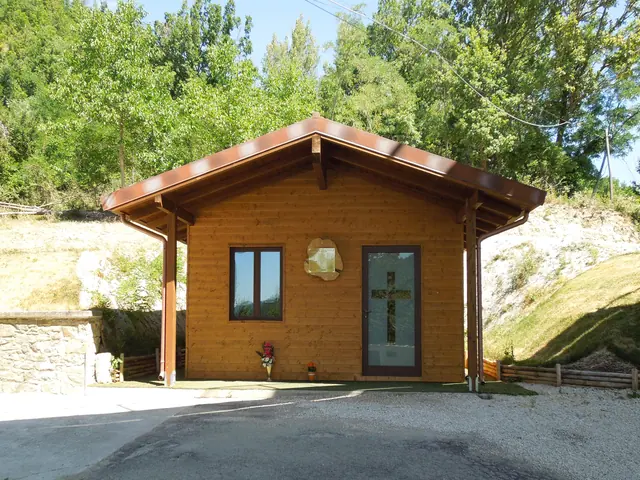
The earthquake of August 24, 2016 almost completely leveled Pescara del Tronto. The hamlet lies along the ancient route of the Salaria, and the European long-distance path E1 also passes through here.
Pretare is the hamlet closest to Monte Vettore and is known as the village of the fairies. According to legend, the Sibyl's handmaidens came down at night to dance with the shepherds. Once they lingered too long and, fleeing at dawn, left a strip of churned earth on the Vettore: the Strada delle Fate. Every three years, in mid-August, for the feast of San Rocco, the pageant "La leggenda delle fate" (The Legend of the Fairies) is staged. Outside the village, along the winding road up to Forca di Presta, a mountain pass, stands an old disused kiln, built next to the limestone that was its raw material. The individual sites are covered in depth on the page about things to do in Arquata del Tronto.
Nature and trails near Arquata del Tronto
Around Arquata del Tronto, trails start mainly from two passes on the border with Umbria, Forca di Presta and Forca Canapine. They range from family-friendly walks to the climb up Monte Vettore, the highest peak in the Sibillini.
The classic climb up Monte Vettore (2,476 m) starts from the Forca di Presta pass, at 1,536 meters. Trail 101 climbs the Vettoretto ridge to the Rifugio Zilioli and then the summit. It is a steep climb, with about 2 and a half hours of walking to reach the top. The CAI (Italian Alpine Club) grades the route E, which becomes EE with the variant toward Lago di Pilato. The lake lies below Pizzo del Diavolo and is home to the chirocefalo del Marchesoni (Marchesoni's fairy shrimp), a tiny crustacean that appears to live only here. Going near the shores beyond the limit marked by posts is prohibited. Since the 2016 earthquake, some trails and access routes, especially toward the lake, are subject to ordinances that change over time. Before setting out, check their status with the Sibillini Mountains National Park, the town hall or the CAI.
There are easy routes too. From Forca di Presta, along the Grande Anello dei Sibillini, the "Sentiero per tutti" (trail for everyone) reaches the Rifugio Belvedere in about 3 km, overlooking the Tronto valley, and then continues along the ridge to Forca Canapine. The Rifugio degli Alpini, near the start, is currently unusable. From Forca Canapine (1,541 m) a gravel road leads to the Pantani di Accumoli, small glacial ponds on the border between the Sibillini and the Laga, at 1,588 meters, where animals graze in the wild. The route is 2.6 km with 65 meters of elevation gain: it takes just over an hour and a half round trip. Both routes are suitable for families and, when there is snow, can be done on snowshoes.
Forca Canapine was long Arquata's ski area. After increasingly snow-poor winters and the 2016 earthquake, its revival depends on redevelopment projects. The municipality is also crossed by the European path E1, which touches Forca di Presta, Forca Canapine, Pretare, Piedilama, Borgo, Camartina, Pescara del Tronto, Tufo and Capodacqua before continuing toward Accumoli.
Where to stay in Arquata del Tronto
Since the 2016 earthquake, the main town and many hamlets of Arquata del Tronto are still being rebuilt. This also affects the range of accommodations. The up-to-date list is on the page about where to stay in Arquata del Tronto.
Where to eat in Arquata del Tronto
For those visiting the higher hamlets of the valley, such as Colle, the nearest places to eat are in Trisungo, in Borgo and in the main town. Bars and restaurants have reopened in the area of the SAE villages. Places and addresses are gathered on the page about Arquata del Tronto restaurants.
Local products of Arquata del Tronto
Arquata del Tronto is a border area and its cooking reflects the neighboring regions. The ingredients are those of the mountains: game, porcini mushrooms, truffles, chestnuts and river trout.
Each hamlet has its specialties. Pretare is known for the Zuppa delle Fate (Fairies' Soup), whose recipe had almost been lost. Spelonga is known for two handmade pastas, zochene and frascatigli, and for the quality of its potatoes. Lentils and beans are grown around Pretare and Pescara del Tronto. Corn is used for polenta, served with sauces of sausage and pork ribs.
In the fall the woods yield porcini, field mushrooms and parasol mushrooms. In the beech forests grows the summer black truffle, scorzone, used for pasta sauces and bruschetta. Among cured meats, ciauscolo stands out, a soft spreadable salami that farmers ate on bread between meals. Work is also under way to revive native grape varieties, including Pecorino d'Arquata. In Colle the old craft of making charcoal survives. On the last weekend of October, Trisungo usually hosts "Marrone che passione", the festival of mountain products. Shops and producers are on the page about Arquata del Tronto local products and shops.
Weather and how to get to Arquata del Tronto
Arquata del Tronto is reached by car along the SS4 Salaria. From Ascoli Piceno, about 30 km away, it takes about 30 minutes. From the A14 highway, exit at San Benedetto del Tronto and take the connector road to Ascoli Piceno. Then continue on the Salaria toward Rome, go through Trisungo and follow the signs for Arquata. The main town is about 30 km from Norcia and 55 km from the Adriatic. Near Trisungo the construction site of the new tunnel is at a standstill and there are several traffic lights on the Salaria: allow for some delays.
Without a car, the nearest train station is Ascoli Piceno. From there, buses run by the Start company reach the municipality in about forty minutes.
The difference in altitude is large, from 580 meters on the valley floor to passes above 1,500 meters, so conditions vary greatly between the town and the mountains. In winter, access to Forca Canapine from the Macerata side, via Castelluccio, can be difficult. Before a high-altitude hike, always check the weather forecast and road conditions.
In this section
6 results
 Things to do in Arquata del Tronto18 places
 Where to stay in Arquata del Tronto8 places to stay
 Arquata del Tronto restaurants9 places
 Pescara del Tronto (Arquata del Tronto)Le Marche · Ascoli Piceno
- Pretare (Arquata del Tronto)Le Marche · Ascoli Piceno
 Arquata del Tronto local products and shops6 places
No results with these filters.