


Forca di Presta: how to get there and trails
At a glance
- Type
- Mountain pass
- Municipality
- Arquata del Tronto (AP)
- Elevation
- 1,534 m
Source: site database, © OpenStreetMap contributors (ODbL).
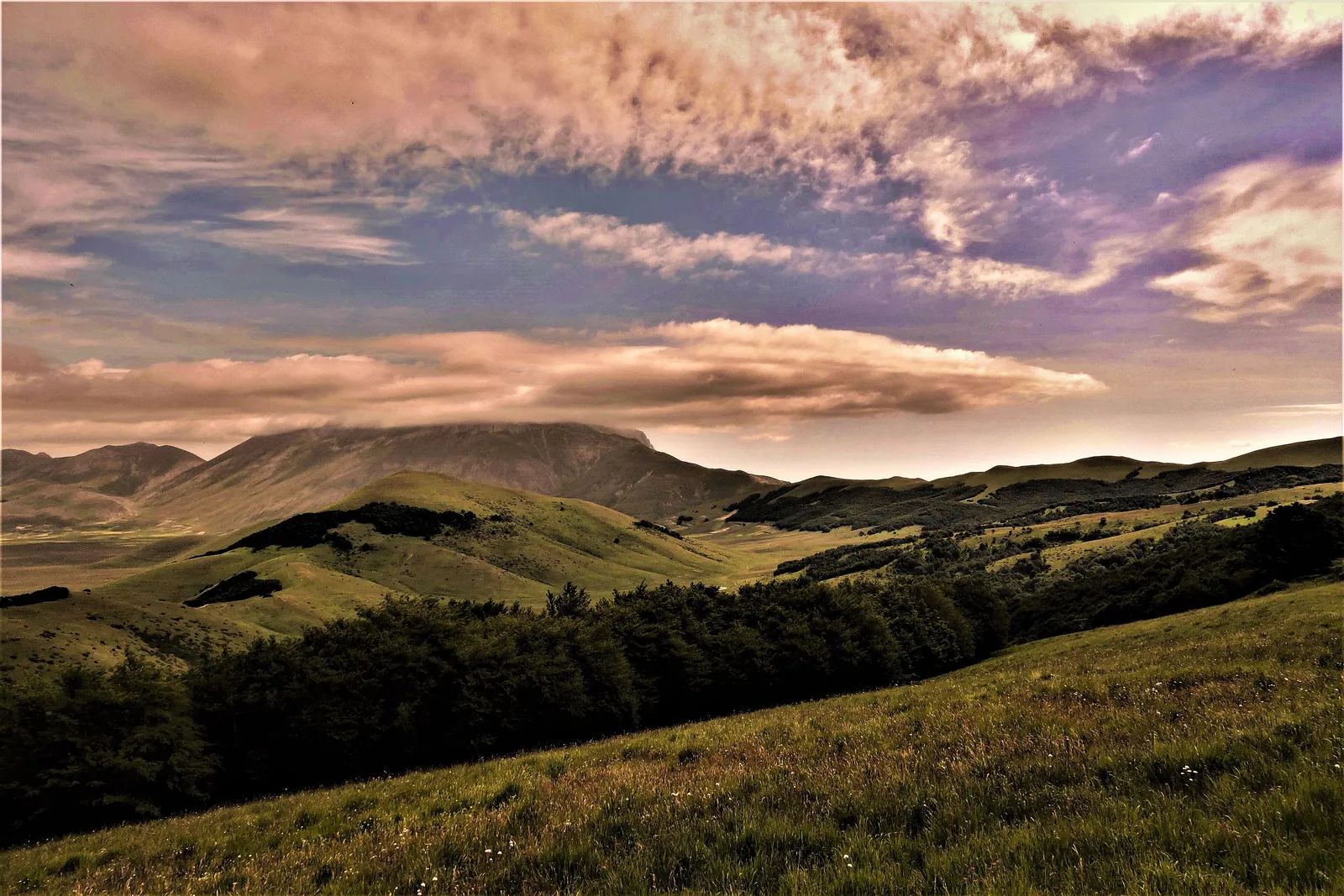
Forca di Presta is the road pass in the Sibillini Mountains that links Arquata del Tronto, in the province of Ascoli Piceno, to the Piani di Castelluccio. It lies at more than 1,500 meters, at the foot of Monte Vettore, the highest peak in Sibillini National Park. From the pass there is a close view of the Arquata face of the Vettore, which rises almost vertically and shows all its rugged rock. From here start the most popular trail to the summit and the Sentiero per Tutti (Trail for All), an accessible route that leads to a viewpoint over the Monti della Laga.
The name combines “forca,” meaning mountain pass, with “Presta,” a word of uncertain origin. Some historians link it to the Sabine goddess Praestitia, others to the Latin verb praestare, understood as “to stand higher.” Giacinto Pagnani records the form “forca de praestitia” in a Norcia deed of 1346, relating to the leasing of land. The pass also has a place in the history of the Risorgimento. The memoirs of Candido Augusto Vecchi relate that Giuseppe Garibaldi crossed it at dawn on January 27, 1849, after spending the night in Arquata, on his way to Rieti. The son of Arquata's governor accompanied him to the top, carrying a silk tricolor flag in his honor.
Before you go
Forecast
- Today12° / 7°0.0 mmCloudy
- Tomorrow13° / 7°5.8 mmLight rain
- Friday10° / 5°25.4 mmHeavy rain
Forecast by MET Norway, updated automatically · license CC BY 4.0
Rules and orders: Park website. Snow and avalanches: Meteomont bulletin.
On the map
Points from the site database. Map © OpenStreetMap contributors · Protomaps.
Where Forca di Presta is
Forca di Presta lies in the municipality of Arquata del Tronto, in the Umbrian-Marche Apennines. It marks the border between the province of Ascoli Piceno, in Le Marche, and that of Perugia, in Umbria. The pass opens at the base of Monte Vettore and is one of the gateways to the Piani di Castelluccio, about ten minutes away by car.
The European long-distance path E1 also crosses the pass. Here stands the Rifugio degli Alpini “Giovanni Giacomini,” long a landmark and reference point, now closed and unusable after the 2016 earthquake. Next to the hut is the open area where cars are left and where the trail to the Vettore begins.
How to get to Forca di Presta
Forca di Presta is reached by car, from both Le Marche and Umbria. Normally there is no public transportation to the pass, so a private vehicle is needed. By car it takes about 20 minutes from Arquata del Tronto, about 30 from Norcia and about ten from Castelluccio di Norcia.
From the Marche side, leave the Via Salaria at the hamlet of Trisungo and climb toward Borgo di Arquata. The road then passes through the hamlets of Piedilama and Pretare. After about 6 km a junction on the left leads to the pass. The road crosses it and continues to Forca Canapine. This provincial road, the SP 34 “Forca di Presta,” was closed after the 2016 earthquake because of loose boulders and a damaged roadway, and was later secured with netting and rock bolts. From the Umbrian side, the climb is from Castelluccio di Norcia along the SP 477.
In winter the road to Forca di Presta may stay closed for a few hours or for days. At other times it can only be driven with winter tires or with chains on board. The stretch between Castelluccio and the pass, for example, was closed after a snowstorm that had trapped several vehicles, and reopened only to cars with winter tires or chains. On the weekends of the Castelluccio flowering, between June and July, access is regulated by ordinances of the Municipality of Norcia that change every year. On those days Forca di Presta serves as a high-altitude parking lot, from which visitors continue by shuttle.
Parking at Forca di Presta is in the open area at the pass, near the Rifugio degli Alpini. On fine days and on summer weekends it fills up quickly, so it is best to arrive in the morning.
Forca di Presta trails and hikes
The best-known trail from Forca di Presta climbs Monte Vettore. It is the most traveled route to the summit and the busiest in the whole group. It follows waymark 101 and starts from the pass, near the Park's wooden information board. Its difficulty is E (hiking). The round trip is about 10 km, with about 930 meters of elevation gain, and takes about five and a half hours of walking. The ascent passes near the cross in memory of the mountaineer Tito Zilioli, skirts Monte Vettoretto (2,052 m) and reaches the Rifugio Tito Zilioli on the Sella delle Ciaule. From there a final stretch on scree and broken rock leads to the summit.
The route has no exposed sections, but it is entirely treeless, always in the sun and without water points. Hiking boots, enough water and attention to the weather, which changes quickly on the Vettore, are needed. In summer it is best to climb in the cooler morning hours. It is not a stroll: anyone without fitness or experience should weigh it carefully.
From the Rifugio Zilioli there is a detour to Lago di Pilato, the lake of the chirocefalo del Marchesoni, a small crustacean discovered in the 1950s. The variant is more demanding (EE, for expert hikers) and adds about 3 km, 300 meters of elevation gain and an hour and a half round trip. After the 2016 earthquakes and the 2017 avalanches this stretch was closed, and access to the lake is subject to ordinances that have changed over time. Before setting out, check the state of the trail with the Park or the CAI. Forca di Presta is also the start of routes to Cima del Redentore and Pizzo del Diavolo.
The Sentiero per Tutti is the easiest outing from Forca di Presta. It was created by the Sibillini National Park authority through the “Un parco per tutti” (A Park for All) project, by restoring a track opened illegally in 1971. It starts near the Rifugio degli Alpini and is about 3 km each way, with little elevation change and always above 1,500 meters. The first stretch is concrete and runs alongside a dirt road. The last is a boardwalk of wooden slats raised 30 cm above the meadow, leading to a mountain hut and a viewpoint. The route is open to walkers, cyclists and people with reduced mobility. In the past a stretch of about 1.1 km had a broken concrete surface, not passable by wheelchair: wheelchair users should check the current condition. The trail can be used only when it is not covered by snow, and it is very exposed to sun and wind.
When to go to Forca di Presta
Forca di Presta can be visited all year. The best time depends on what you want to do. For the Vettore the recommended seasons are summer and fall: in late spring there may still be patches of hard snow along the trail. In spring the pastures around the pass bloom, including rare species, and are hunting grounds for buzzards, kestrels and golden eagles. During migration the lesser kestrel, a rare raptor, can also be seen.
In summer hikers and trekking enthusiasts arrive. From June to September the thermals attract hang-glider pilots and model-aircraft flyers. Between August and September the area offers mushrooms such as the parasol mushroom, and from July to October the field mushroom. Before picking mushrooms, check the rules in force in the Park.
In winter, abundant snowfall allows cross-country skiing, and the pass has also been a stop on snowshoe hikes in the Sibillini. In this season thick fog banks can form, and the road may be closed or passable only with winter equipment. Before driving up, check the weather and road conditions.
What to see near Forca di Presta
The first view is the pass itself, with the face of the Vettore towering above it. From the viewpoint at the end of the Sentiero per Tutti the view reaches the Monti della Laga, on the border with Abruzzo. Also visible are the Marche villages of Faete, Spelonga, Colle di Arquata and Arquata del Tronto, and Amatrice, in Lazio. Two panels help identify the places. The route mostly follows the ridge of Monte Forciglieta, Monte Pellicciara and Monte Macchialta, among pastures and patches of beech. From the crest the view reaches the Tronto valley, Monte Ceresa, the Monti Gemelli and, farther away, the Gran Sasso.
Heading down toward Umbria leads to the Piani di Castelluccio, the karst plateaus famous for their flowering. Continuing on the road past the pass leads to Forca Canapine, the ski area whose lifts have been idle since the 2016 earthquake. On the Marche side, between the pass and Arquata del Tronto, is the aqueduct called “la Botte,” in an area where a few porcini can be found in September. Other passes of the massif are described on the page about the mountain passes of the Sibillini.
Frequently asked questions
Where can you eat at Forca di Presta?
Where is Forca di Presta?
How do you get to Forca di Presta and where do you start?
What is there to see at Forca di Presta?
Is there snow at Forca di Presta today?
Where do you park for Forca di Presta?
What is there to do at Forca di Presta?
Nearby
What to see nearby
- Monte VettorettoPeak2.3 km
- 2.9 km
- 3.2 km
Where to stay
- 2.8 km
- Rifugio Belvedere, Arquata del TrontoMountain hut2.9 km
- Bivacco Tito Zilioli, Arquata del TrontoBivouac or unstaffed hut3.1 km
Where to eat
- Arquata Cafè, Arquata del TrontoBar and café3.1 km
- Terre In Seme, Arquata del TrontoDelicatessen3.1 km
- Star Tours Incoming, Arquata del TrontoBike rental3.1 km
Straight-line distances.