


Cima del Redentore: how to get there and trails
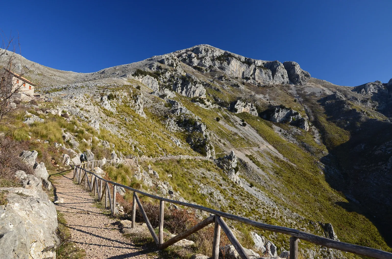
Cima del Redentore (2,448 m) is the highest peak in Umbria and the second highest in the Sibillini Mountains, after Monte Vettore, which tops it by a small margin. It lies on the border between Umbria and the Marche, on the ridge that separates the Piano Grande di Castelluccio from the valley of Lago di Pilato. The best-known view of the mountain is from the Piani di Castelluccio: from there the Cordone rock band and the spur of the Scoglio dell'Aquila can be recognized. On the western side it is the most visible peak of the group, and for this reason it is often mistaken for the Vettore. It was once known by that very name.
On the summit there is a small cross. The first winter ascents of Cima del Redentore and the Vettore date back to 1876 and were made by the mountaineer Damiano Marinelli, who climbed with two mountain men from Castelluccio. Today the most popular routes start from Forca di Presta and from the plain of Castelluccio di Norcia. They are high-altitude hikes, with ridge sections exposed to drops and wind, and the 2016 earthquakes left their mark on the access roads, the mountain huts and the ground.
Before you go
Forecast
- Today9° / 5°0.0 mmCloudy
- Tomorrow10° / 5°5.8 mmLight rain
- Friday7° / 3°25.4 mmHeavy rain
Forecast by MET Norway, updated automatically · license CC BY 4.0
Rules and orders: Park website. Snow and avalanches: Meteomont bulletin.
On the map
Points from the site database. Map © OpenStreetMap contributors · Protomaps.
Where Cima del Redentore is located
Cima del Redentore is in the Sibillini Mountains National Park, in the Monte Vettore group, on the border between the province of Perugia and that of Ascoli Piceno. Among the peaks overlooking the Piano Grande di Castelluccio, it is the highest.
The highest ridges of the Sibillini form a horseshoe around Lago di Pilato, which lies at the foot of Cima del Redentore. The Vettore dominates the lake from the east. On the western ridge, instead, come Punta di Prato Pulito, Cima del Lago and Cima del Redentore. From the summit a secondary ridge about 400 meters long runs east, ending at Pizzo del Diavolo (2,410 m). The walls of the Pizzo drop sheer into the lake basin.
To the north the ridge continues with Cima dell'Osservatorio (2,350 m), Quarto San Lorenzo (2,247 m) and Cima di Forca Viola (2,230 m). It then descends to Forca Viola (1,936 m), an old pass between the eastern and western sides of the Sibillini.
How to get to Cima del Redentore
The climb to Cima del Redentore usually starts from one of two points: the Forca di Presta pass (1,536 m) or the plain below Castelluccio di Norcia. Both require a car.
Forca di Presta is reached from the Marche via Arquata del Tronto or Montegallo, and from Umbria via Castelluccio or Norcia. At the pass there is plenty of parking space. The historic Rifugio degli Alpini, on a hill near the pass, has been unusable since the 2016 earthquake.
On the Castelluccio side, drive down from the pass toward the plain and park in a clearing at the start of a dirt road, at Piè di Colle (about 1,318 m), just before the road climbs toward the village.
Before setting out, it is wise to check whether the roads are open. On March 19, 2026, the Castelluccio provincial road was closed due to avalanche danger: the Province of Perugia reopened it in May 2026. At 1,536 meters, snow and ice can make crossing the pass difficult; there is no fixed seasonal closure.
There is also an approach from Foce di Montemonaco: the route climbs to Lago di Pilato and then to the Zilioli hut. After the 2016 earthquakes, however, some routes in the Lago di Pilato valley were closed by ordinance. The classic stretch of the "Svolte" (switchbacks) was hit by landslides and ground slips. Before choosing this way, it is essential to check that it is passable.
Trails and hikes to Cima del Redentore
The shortest trail to Cima del Redentore starts from Forca di Presta: the elevation gain is 900-950 m and it takes from 5 hours 15 to 5 hours 45 minutes round trip. The difficulty is E/EE. The climb from Castelluccio goes via Forca Viola instead: it is longer and graded EE.
From Forca di Presta. Follow trail 101 toward the Zilioli hut. After a steep initial ramp, the trail climbs along the open ridge, passes the Croce Zilioli and a saddle above the Vettoretto. A rising traverse then leads to the hut, at about 2,240 m. The old Zilioli hut had been made unusable by the earthquake: the Ascoli Piceno section of the CAI (Italian Alpine Club) replaced it with a modern structure that has a room always open. Behind the hut, climb the east ridge of Punta di Prato Pulito (2,373 m). At first the ridge is sharp, then it widens (difficulty I+). Descend to a saddle and climb again to Cima del Lago (2,422 m), which probably offers the best view of Lago di Pilato. Finally a long ridge, very panoramic and exposed in places, crosses a few ups and downs and reaches Cima del Redentore. Return the same way: from the summit to Forca di Presta takes about 2 hours and 15 minutes.
From Castelluccio via Forca Viola. The route starts at the foot of the village and climbs toward Capanna Ghezzi and Colle Abieri. It then traverses the southwestern slope of Monte Argentella to Forca Viola (about 2 hours and 35 minutes). From here, follow the ridge south, climbing a steep slope. The route passes below Cima di Forca Viola, then crosses Quarto San Lorenzo and Cima dell'Osservatorio. Over rocky, exposed passages it reaches the summit cross in about 4 hours and 15 minutes. The elevation gain is about 1,200 m and the return takes about 3 hours. Along the climb there are views of the Castelluccio basin, the Lago di Pilato valley and the central Apennines.
The ridge loop. Fit hikers can combine the two routes in a loop of about 22 km from Forca di Presta. The loop takes in Punta di Prato Pulito, Cima del Lago, the Redentore, Cima dell'Osservatorio, Quarto San Lorenzo and Cima di Forca Viola, and descends from Forca Viola on a traversing trail. It is graded EE and takes a full day of walking.
The detour to Pizzo del Diavolo. From the summit a narrow, very airy ridge leads to Pizzo del Diavolo. The round trip involves about 150 m of elevation gain, with exposed sections without fixed equipment. The detour is optional and can be skipped.
The earthquake also left traces at altitude. In 2017 deep cracks in the ground could be seen from Quarto San Lorenzo onward, small sinkholes between the Redentore and Punta di Prato Pulito, and the summit of Pizzo del Diavolo full of deep fissures. Along the loop water is not available everywhere, so it is wise to set out with a good supply.
When to climb Cima del Redentore
The best period for Cima del Redentore is from June to October, generally from late spring to autumn. With snow the climb becomes a mountaineering ascent, suitable only for experienced people with the right equipment.
In every season the weather must be taken into account. The ridges are exposed to the wind, which can be very strong here, and to lightning during storms. It is best to start early and turn back if the weather is uncertain.
In winter an ice axe and crampons are needed. In the past the most direct route from the Piano Grande di Castelluccio was recommended precisely for the winter season and was used by a few mountaineers and some ski mountaineers. In the cold months the Lago di Pilato valley is dangerous because of avalanches, so those heading to the heights start from Forca di Presta.
The landscape also changes with the seasons. Lago di Pilato forms in May, when the snow melts. In summer it can dry up almost completely, as has happened in drought years.
What to see near Cima del Redentore
Lago di Pilato, at 1,941 m in the municipality of Montemonaco, is the best-known destination near Cima del Redentore. It is the only natural lake in the Marche and one of the very few alpine-type glacial lakes in the Apennines. The lake is home to the chirocefalo del Marchesoni, a small crustacean (a fairy shrimp) discovered in 1954 and described as a new species in 1957. Strict rules protect it: swimming and entering the water are prohibited, visitors must stay at least 5 meters from the shore and, when the lake is dry, walking on the dry bed is not allowed.
Pizzo del Diavolo overlooks the lake with a vertical limestone face, climbed by demanding rock routes, next to the Gran Gendarme tower.
On the same ridge as the Redentore are Cima del Lago, Cima dell'Osservatorio and Cima di Forca Viola. On the other side of the lake valley rises Monte Vettore, the highest peak of the group. Below the western side opens the Piano Grande di Castelluccio. To find your way among the other peaks of the park, see the page on the peaks of the Sibillini Mountains.
Frequently asked questions
How long does it take to climb Cima del Redentore?
Is the climb to Cima del Redentore difficult?
Can you climb Cima del Redentore in winter?
Are there mountain huts or water sources along the trail?
Nearby
What to see nearby
- 700 m
- Lago di PilatoLake800 m
- 1.2 km
Where to stay
- Bivacco Tito Zilioli, Arquata del TrontoBivouac or unstaffed hut1.4 km
- La Valle Delle Aquile, NorciaFarm stay3.8 km
- Locanda De' Senari, NorciaFarm stay3.8 km
Where to eat
- Classe 62, MontemonacoClimbing2.6 km
- Adrenalina, MontegalloClimbing2.6 km
- 3.3 km
Straight-line distances.