


Mountain passes of the Sibillini: valichi and forche
The mountain passes of the Sibillini, known locally as valichi and forche, are the crossings from one valley to the next along the range that separates Le Marche from Umbria, inside the Sibillini Mountains National Park. In this area a «forca» is the saddle linking two sides of the mountains: some are crossed by paved roads, others can be reached only on foot. Elevations range from about 1,000 m at the Forca di Ancarano, above Norcia, to about 1,936 m at Forca Viola, below the Redentore ridge.
For many hikers a pass is the starting point: from Forca di Presta the trail climbs Monte Vettore, from Forca Canapine a route leads to the Pantani di Accumoli, from the Forca di Gualdo a trail descends to the village of Gualdo. Other passes, such as Forca di Giuda or Passo Cattivo, are intermediate stops on long routes, from the Grande Anello dei Sibillini to the climb up the Gola dell'Infernaccio. The 2016 earthquake greatly changed life around the passes: roads closed for years, huts declared unsafe, lifts shut down. Some have become accessible again, others have not.
The places
4 results
 Forca CanapineGuide
- Mountain passForca di GualdoMountain pass · Castelsantangelo sul Nera
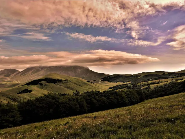 Forca di PrestaMountain pass · Arquata del Tronto
- Forca ViolaGuide
No results with these filters.
On the map
Points from the site database. Map © OpenStreetMap contributors · Protomaps.
Mountain passes of the Sibillini: the map
The busiest passes are in the southern sector of the Park, around the Piani di Castelluccio. The Pian Grande, the Pian Piccolo and the Pian Perduto form a vast closed basin at about 1,350 m, surrounded by ridges and passes.
From the south, on the boundary between Arquata del Tronto and Norcia, lies Forca Canapine (1,541 m). Not far away, at the Forca dei Pantani (about 1,600 m), Umbria, Le Marche and Lazio meet. Following the crest north leads to Forca di Presta, the road pass between the province of Ascoli Piceno and that of Perugia, at the foot of Monte Vettore. The road that climbs to Forca di Presta continues to Forca Canapine.
Above the Pian Grande, Forca Viola (about 1,936 m) opens below the ridge climbing to Cima del Redentore: it is the crossing on foot between the Castelluccio plateau and the valley of Lago di Pilato. On the Norcia side, between the Piani and the Valle del Campiano, are the Forca di Giuda (1,794 m) and, much lower, the Forca di Ancarano. Finally, near the Pian Perduto, on the road between Castelluccio and Castelsantangelo sul Nera, lies the Forca di Gualdo (1,496 m).
In the northern sector of the Park the passes are more isolated. Passo Cattivo (1,869 m) sits on the watershed between Frontignano di Ussita and the upper Val Tenna. Farther north still, the Forcella del Fargno (1,811 m) links Bolognola and Ussita, facing the north face of Monte Bove. Along the Grande Anello dei Sibillini, which follows the whole range for about 124 km in nine stages, hikers also cross the pass at Pintura di Bolognola.
A simple way to get your bearings:
- Forca Canapine (1,541 m): Arquata del Tronto and Norcia, provincial road.
- Forca di Presta (over 1,500 m): Arquata del Tronto, provincial road, start for Monte Vettore.
- Forca Viola (about 1,936 m): between Castelluccio and the Lago di Pilato valley, on foot only.
- Forca di Giuda (1,794 m) and Forca di Ancarano (about 1,008 m): Norcia, trails 581 and 582.
- Forca di Gualdo (1,496 m): Castelsantangelo sul Nera, road to Castelluccio.
- Passo Cattivo (1,869 m): between Frontignano and the Val Tenna, on foot.
- Forcella del Fargno (1,811 m): between Bolognola and Ussita, dirt road.
Mountain passes of the Sibillini: the places not to miss
Forca di Presta. This is the best-known pass in the Park. It lies in the municipality of Arquata del Tronto, on the border between Le Marche and Umbria, and can be reached by car both from Arquata, climbing via Piedilama and Pretare, and from Castelluccio, about ten minutes away. Above the open area of the pass rises the face of Monte Vettore, the highest peak in the Sibillini (2,476 m). Trail 101 to the summit starts here: the round trip is about 10 km, with about 930 m of elevation gain and five and a half hours of walking, on ground with no trees and no water. The Park's E15 hiking route continues beyond the summit to Santa Maria in Pantano, while the E16 loop links the pass with Arquata del Tronto through the chestnut woods. For a gentle walk there is the Sentiero per Tutti (Trail for All): about 3 km above 1,500 m, also suitable for wheelchairs, to a viewpoint over the Monti della Laga. At the pass, the Rifugio degli Alpini has been closed and unsafe since 2016.
Forca Canapine. The pass is shared between Arquata del Tronto and Norcia. To the west it looks over the Pian Grande, to the east over the face of Monte Vettore on the Arquata side. For a long time it was one of the main ski resorts of the Umbria-Marche Apennines, but the lifts have been idle since the 2016 earthquake. Provincial road 64 «Nursina», damaged by the earthquake, became fully passable again on July 11, 2025. In fall 2026 the Municipalities of Norcia and Arquata del Tronto, the two Provinces and the BIM del Tronto started the process for a consortium to relaunch the area year-round; the consortium has not yet been formed. Today the most popular destination is the Pantani di Accumoli, about 2.6 km and 45 minutes from the pass on a gravel road and then a track: it is an easy route, done on snowshoes in winter. The European long-distance path E1 also crosses the pass.
Forca di Gualdo. On the pass, in the municipality of Castelsantangelo sul Nera, stands the Church of Madonna della Cona, with views of the Pian Perduto of Castelluccio, the Vettore group and Monte Lieto. In the past, on the first Sunday of July, Castelsantangelo and Castelluccio came up here in procession for the Festa della Cona. The road climb from Castelsantangelo sul Nera measures almost 10 km and has 17 hairpin bends. On foot, trail 253 descends 3.8 km and 500 m to the village of Gualdo, while trail 251 climbs to Monte Pian Falcone. The Park's E11 route, «Nel territorio del cervo» (In red deer country), is a 14.9 km loop with 1,200 m of elevation gain that starts from Nocelleto, passes the Madonna della Cona and crosses the area where red deer have returned after more than two hundred years of absence.
Forca Viola. This is a grassy pass on the border between Le Marche and Umbria, reachable only on foot. The start is Castelluccio di Norcia: a dirt road leads to the Capanna Ghezzi, at about 1,570 m, and from there a trail of about 3 km and about 370 m of elevation gain climbs to the pass. On one side are the Piani di Castelluccio, on the other the gorge leading to Lago di Pilato. Beyond the pass, routes descend toward the lake or climb the ridge toward Cima del Redentore and Pizzo del Diavolo, stretches for expert hikers.
Forca di Giuda and Forca di Ancarano. These are two passes on the Norcia side linked by trail 581. The Forca di Ancarano, at about 1,008 m, has a picnic area and a spring. From here trail 581 climbs the Patino valley, passes near the Grotta di Patino and reaches the Forca di Giuda, at 1,794 m, the highest point of the entire Grande Anello dei Sibillini. Beyond the pass the view opens over the Valle del Campiano. The Park's E14 route, «Dall'alta collina alla montagna» (From the high hills to the mountains), joins the two passes and Monte delle Rose (1,864 m) in a 10.7 km loop with 970 m of elevation gain, graded for expert hikers.
Passo Cattivo. The pass, at 1,869 m, links the western pastures of Monte Bove, above Frontignano, with the upper Val Tenna and the Gola dell'Infernaccio. On the west side it is a wall of rock; to the east it slopes gently toward the valley. The Park's E9 route climbs the Gola dell'Infernaccio from Rubbiano to Capotenna and then to the pass: 14.9 km one way and 1,680 m of elevation gain. Today, however, the section from the second junction for the Eremo di San Leonardo to Arcofù is closed to vehicles and pedestrians by ordinance of the Municipality of Montefortino: from Capotenna to the pass, and on toward Ussita, Castelsantangelo sul Nera or Visso, it will only be possible to continue once the trail reopens. From the Frontignano side, from the Monte Cornaccione parking area, the pass is about an hour's walk; until December 31, 2026, however, this approach passes through the construction area of the Frontignano-Cornaccione gondola lift, where Ordinance no. 48 of August 25, 2026 of the Municipality of Ussita bans passage even on foot.
Forcella del Fargno. The pass, at 1,811 m, is the crossing between Bolognola and Ussita. The Rifugio del Fargno stands here, an octagonal concrete building. From Pintura di Bolognola the Strada del Fargno climbs about 6 km and 500 m: the stretch from Pintura is closed to motor vehicles and is walked or cycled. From the pass, Pizzo Tre Vescovi (2,092 m), the old boundary point between the dioceses of Camerino, Spoleto and Fermo, is less than an hour away. The Park's E5 route climbs from Bolognola to the pass and to Pizzo Acuto.
Mountain passes of the Sibillini: tips for your visit
The road passes can be reached only by private vehicle. At Forca di Presta and Forca Canapine parking is along the roadside or in the open area of the pass; at Forca di Presta, on fine summer days, spaces run out early. On the weekends of the Castelluccio bloom, access to the Piani is regulated every year by ordinances of the Municipality of Norcia, and Forca di Presta becomes a parking area from which visitors continue by shuttle.
In winter the roads above 1,500 m may stay closed for snow, even for days, or be passable only with winter tires or chains. Before setting out, check the weather and road conditions. The same goes for the gravel roads: the Strada del Fargno, for example, was closed in spring 2026 because of avalanche risk, and in previous years it also had long closures.
Many trails starting from the passes are at high altitude, exposed to the sun and without water sources. Boots, enough water and attention to the weather, which changes quickly on Monte Vettore, are essential. In late spring there may still be hard snow on the higher slopes; with snow and ice the climb to Forca Viola changes completely and the avalanche risk is high.
Since the 2016 earthquake part of the trail network has been subject to ordinances. The Park publishes the map of current ordinances and restrictions and the status of every official route; access to Lago di Pilato in particular has changed several times. Several starting villages, such as Borgo di Arquata, Gualdo or Macchie, were badly damaged: in some cases the trail starts from a different point than the one marked on maps. On several trails in the Monte Vettore and Lago di Pilato area, including trail 552 starting from Forca Viola, bicycles are not allowed.