


Pian Perduto: How to Get There and Trails
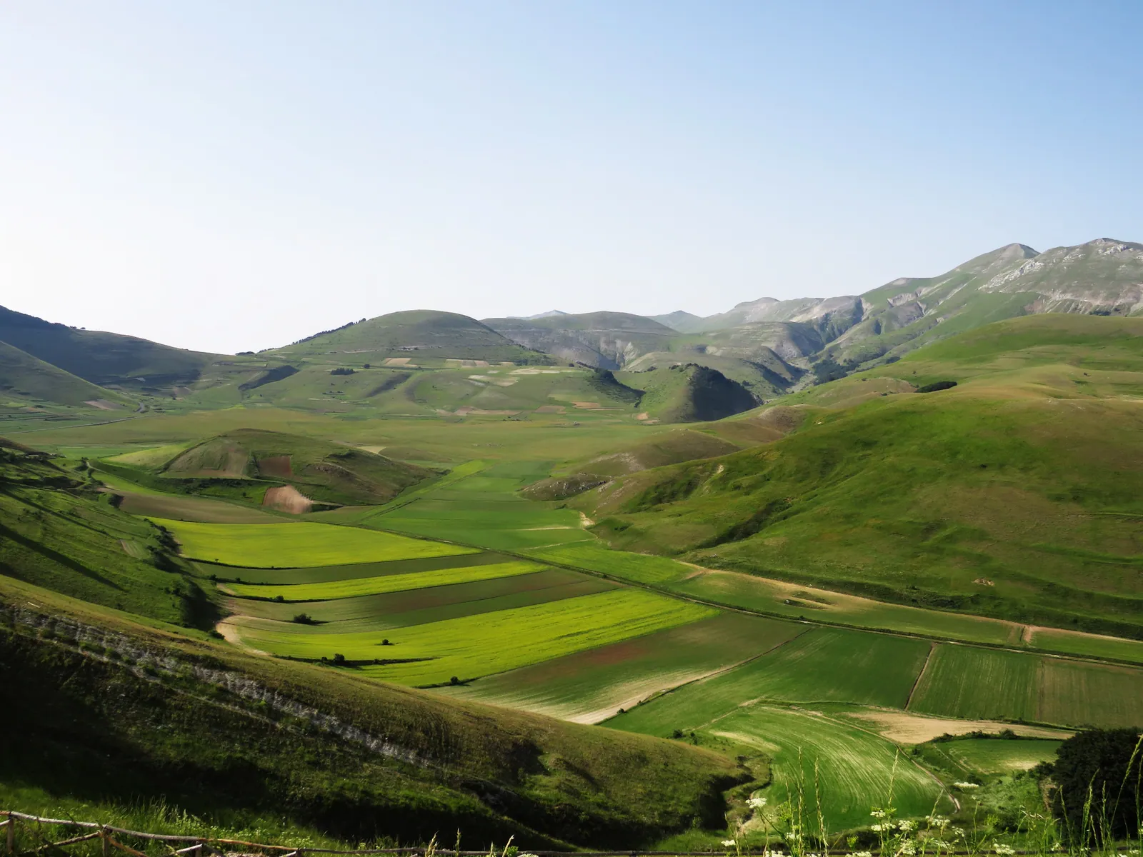
The Pian Perduto is one of the four karst plateaus of the Sibillini National Park in the Sibillini Mountains, together with the Pian Grande, the Pian Piccolo and the Piano dei Pantani. It lies in the municipality of Castelsantangelo sul Nera (Macerata), in the Marche, and is reached by provincial road 136. The name has a historical origin: the area was once called Piano di Quarto and was renamed Pian Perduto ("lost plain") after a bloody battle.
The most eagerly awaited period runs from late May to July: in those months the fields turn red, yellow, purple and blue with poppies, cornflowers, lentils and other wild species. Compared with the Pian Grande, the Pian Perduto is a more intimate and wilder place, often less crowded.
After the 2016 earthquake the area remained hard to reach for a long time: before setting out, it is wise to check the state of roads and trails. Information is available from the Municipality of Castelsantangelo sul Nera or the Park.
Before you go
Forecast
- Today14° / 11°0.0 mmCloudy
- Tomorrow16° / 11°7.3 mmLight rain
- Friday13° / 9°31.2 mmHeavy rain
Forecast by MET Norway, updated automatically · license CC BY 4.0
Rules and orders: Park website. Snow and avalanches: Meteomont bulletin.
On the map
Points from the site database. Map © OpenStreetMap contributors · Protomaps.
Where the Pian Perduto Is
The Pian Perduto occupies the northern part of the Piani di Castelluccio, in the Sibillini National Park. The plateau lies at about 1,300 m and is bounded to the north by the Gualdo pass and to the south by the village of Castelluccio di Norcia.
It is part of the Piani di Castelluccio, together with the Pian Grande and the Pian Piccolo. The plain is the floor of an ancient Apennine lake that has since dried up, and sinkholes and karst features mark its landscape. Castelluccio stands on a hill between the Pian Grande and the Pian Perduto, at an altitude of 1,452 m. From the village square the view takes in the Pian Grande, the Pian Piccolo, the Pian Perduto and Monte Vettore.
For a comparison with the other plateaus, see the page Plains and plateaus of the Sibillini Mountains.
How to Get to the Pian Perduto
Access from Castelsantangelo sul Nera is via provincial road 136 "di Pian Perduto". The road links Castelsantangelo sul Nera with Monte Prata and Castelluccio. It was one of the roads hit hardest by the earthquake, but also one of the most used by tourists heading up into the Sibillini.
The earthquake, between August 2016 and January 2017, badly damaged the roadway, and Anas (the national road agency) carried out repair and safety works. In December 2020 the Province of Macerata issued an ordinance reopening it to traffic, with a 60 km/h limit on part of the route. In earlier years, during the works, the road had already been opened in several phases, in some seasons only on summer weekends. Restrictions therefore change from year to year. Check the ordinances of the Province of Macerata before setting out.
During the 2026 flowering, a shuttle was planned from the Monte Prata parking lot to Castelluccio. Services of this kind depend on the year and should be checked each time.
Pian Perduto Trails and Hikes
The Pian Perduto lends itself to quiet walks. For those who prefer slow travel, with walks suitable for the whole family, the crossing of the Pian Perduto and the various flowering routes are offered from May to July.
A day loop crosses the paved road to Forca di Presta, passes at the foot of Castelluccio and reaches the Pian Perduto. The Portella del Vao links the Pian Perduto to the San Lorenzo area, with Monte Palazzo Borghese in the background. There are also hiking guides with routes between the Pian Grande, the Pian Piccolo, the Pian Perduto and the surrounding peaks, a way to get away from the crowds.
The more demanding routes toward the nearby peaks call for preparation and attention to the weather. The state of the trails after the earthquake should be checked before setting out.
When to Go to the Pian Perduto
The best season runs from late May to July, when the wild flowering alternates with the flowering of the cultivated fields. Between late May and mid-July the Pian Perduto, together with the Pian Grande, is colored by poppies, gentians, narcissi, violets and buttercups.
Those looking for an alternative to summer can choose the end of summer. Autumn crocus blooms around the Pian Perduto, and the best time to see it runs from August 20 to the first half of September. Between June and September it is possible to come across the "Tovel dei Sibillini", a small red pond. The water changes color because of a phenomenon linked to algae, described as unique in the Apennines.
In winter a cross-country ski trail of a couple of kilometers is reported. Given the restrictions linked to the earthquake, it is best to ask about actual accessibility beforehand.
What to See Near the Pian Perduto
The closest neighbor is Castelluccio di Norcia, with its square overlooking the three plateaus. A little farther on is the Pian Grande, described on the Pian Grande page, while the Pian Piccolo has a separate page. The Park's plateaus also include the Piano dei Pantani.
From Castelluccio it is possible to continue toward Lago di Pilato: it can be reached directly via Forca Viola or across Monte Vettore, climbed from Forca di Presta.
On the Marche side, Castelsantangelo sul Nera is worth a stop. The village, at 780 m, largely keeps its medieval layout. This is where the plateau's history has its reference point: the battle of Pian Perduto, fought and won by the people of Visso on July 20, 1522. It was also told by Berrettaccia, a shepherd-poet from Castelsantangelo, in a short poem in ottava rima.
Frequently asked questions
Is the Pian Perduto part of the Piani di Castelluccio?
When does the Pian Perduto bloom?
Why is it called Pian Perduto?
Is the Pian Perduto quieter than the Pian Grande?
Nearby
What to see nearby
- 500 m
- 700 m
- 700 m
Where to stay
- 800 m
- 1.6 km
- 1.9 km
Where to eat
- 800 m
- Bar Rita, Castelsantangelo sul NeraPub and brewery1.9 km
- Norcineria Alto Nera, Castelsantangelo sul NeraButcher and pork products1.9 km
Straight-line distances.