


Forca Canapine: how to get there and trails
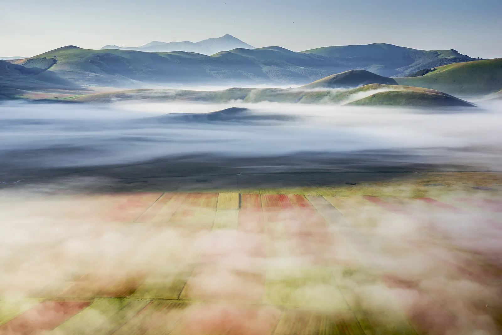
Forca Canapine is a road pass at 1,541 m in the Sibillini Mountains, near the point where Umbria, Le Marche and Lazio meet. The pass lies within Sibillini National Park and is divided between the municipality of Arquata del Tronto (province of Ascoli Piceno) and that of Norcia (province of Perugia). From here the view runs in two opposite directions: to the west is the Piano Grande of Castelluccio, to the east the face of Monte Vettore on the Arquata side. The name combines “forca,” meaning a mountain pass, with the memory of the hemp (canapa) once grown and harvested in the nearby fields.
Between 1970 and 1995 Forca Canapine was an important ski area in central Italy. The 2016 earthquake stopped the lifts, which are still closed, and cut off the access roads for a long time: the SP64 Nursina became fully passable again only in July 2025. Today the pass is above all a starting point for hikes: the Pantani di Accumoli, the Grande Anello dei Sibillini, the European long-distance path E1. In fall 2026 the municipalities of Norcia and Arquata del Tronto, the provinces of Perugia and Ascoli Piceno and the BIM del Tronto began setting up a consortium to revive the area year-round.
Before you go
Forecast
- Today12° / 7°0.0 mmCloudy
- Tomorrow13° / 7°8.0 mmLight rain
- Friday10° / 7°32.8 mmHeavy rain
Forecast by MET Norway, updated automatically · license CC BY 4.0
Rules and orders: Park website. Snow and avalanches: Meteomont bulletin.
On the map
Points from the site database. Map © OpenStreetMap contributors · Protomaps.
Where Forca Canapine is
Forca Canapine lies in the southern sector of Sibillini National Park, on the border between Le Marche and Umbria. On the Marche side it belongs to Arquata del Tronto, on the Umbrian side to Norcia, and for both municipalities it is a hamlet. A short walk away, at Forca dei Pantani (1,607 m), Umbria, Le Marche and Lazio meet. Just beyond that saddle lie the Pantani di Accumoli, already in Lazio.
The pass has a history tied to road and trail. The two roads climbing to Forca Canapine have been chosen several times as a route of the Giro d'Italia: the Norcia side since 1921, the Arquata side since 1924. The European long-distance path E1, which links North Cape to Capo Passero, also crosses the pass.
After the 2016 earthquake the small settlement at the pass was left largely empty. Visitors should expect a mountain locality awaiting reconstruction rather than a resort with services.
How to get to Forca Canapine
Forca Canapine can only be reached by private vehicle. There is no permanent public transportation; in the past only summer services have been run.
From the Via Salaria, at Trisungo, take the SS685 “Tre Valli Umbre” toward Norcia-Cascia and then turn onto the SP64 Nursina, which climbs to the pass. Coming from the Adriatic coast the route is simple: expressway to Ascoli Piceno, then the Salaria toward Rome, past Acquasanta Terme and Arquata del Tronto, to the junction signposted for Norcia. From there the road starts to climb but remains easy. There is also a second route, again starting from Trisungo toward Arquata del Tronto: at Borgo, continue toward Castelluccio di Norcia.
On the Umbrian side, the climb is from Norcia and Castelluccio. Coming down from Castelluccio, leave the main road to climb to the pass, on a scenic stretch with good asphalt.
The SP64 stayed closed for years after the earthquake. The section from Norcia reopened in December 2019, and the full link between the two sides in July 2025, after works costing more than €15 million. At the pass, parking is along the roadside. In winter snow can make driving difficult, so check road conditions before setting out.
Forca Canapine trails and hikes
The most popular hike from Forca Canapine leads to the Pantani di Accumoli. It is an easy route, suitable for families too and doable all year; with snow it works well on snowshoes. From the pass, follow the signposted gravel road toward the Pantani, which then becomes a track with no forks. Keep Monte Serra (1,744 m) on your left and descend to Forca dei Pantani, then reach the small ponds at 1,588 m. The outward leg is about 2.6 km, with 65 m of elevation change, and takes about 45 minutes. The round trip takes a little over an hour and a half. The Pantani are part of the Natura 2000 network and are home to the yellow-bellied toad and the crested newt. Horses and cows graze freely in the basin. About 500 m past the first pond, a short ditch ends in a sinkhole.
For a longer outing there is the Forca Canapine – Monte Utero – Pantani di Accumoli loop: about 12 km and 6 hours of walking. The difficulty is E (hiking) and the physical effort moderate.
From Forca di Presta to Forca Canapine the walk follows the Grande Anello dei Sibillini (GAS), a route of about 124 km divided into 9 stages. This stretch follows trail 104 and the GAS, is 8.2 km long, takes about 2 hours and has 144 m of elevation gain. It runs almost entirely on the level along an open ridge, with views of the Sibillini Mountains and the Monti della Laga, and reaches Colle le Cese, near Forca Canapine. It is easy, and in winter, with snow, it is done on snowshoes. Between Colle le Cese and Forca Canapine the track is poorly marked: a GPS is advisable. There are no water points along the way. Forca Canapine is also on a variant of the Sentiero Italia, chosen for its view of the Vettore group.
In summer the pass also draws people for mountaineering, paragliding, hang gliding and horseback riding.
When to go to Forca Canapine
Forca Canapine can be visited all year, but each season offers a different experience.
From spring to fall people come to hike, fly and ride. Because of its elevation and low light pollution, the pass also attracts amateur astronomers and astrophotographers. The best months for stargazing are July and August, but the area works well from May to September-October. There is some street lighting near the buildings, while a short move away there are very dark spots with no traffic.
In winter snowfall is abundant. Thanks to the elevation and the air currents, snow often lasts until late spring, and the trail to the Pantani becomes an easy snowshoe walk. Skiing, however, is not available today. Before the earthquake the ski area, called “Vallermosa,” offered about 16 km of runs between Colle Cascina (1,610 m) and Colle Saliere (1,560 m) and a loop of about 10 km for cross-country skiing. The lifts have been idle since 2016. The consortium launched in 2026 plans to restore lifts and tourist facilities, but for now there are no reopening dates.
What to see near Forca Canapine
The first sight is the pass itself. From Forca Canapine the whole plain of Castelluccio di Norcia comes into view, and on the opposite side the face of Monte Vettore drops toward Arquata.
On the knoll beyond the houses, overlooking Piazzale Ascoli, stands the Chiesa della Beata Vergine del Carmelo, in the part of the pass that belongs to Arquata del Tronto. It was built by the Provincial Administration of Ascoli Piceno in the early 1960s and inaugurated on July 16, 1965. It is made of travertine blocks, with a simple bell gable; inside is a single rectangular hall with an apse, lit by nine single-light windows with stained glass.
Besides the ponds of the Pantani di Accumoli, those with more time can climb Monte dei Signori (1,781 m), which overlooks the Pian Grande and the Sibillini. Along the ridge to Forca dei Pantani stands a 19th-century boundary stone between the Papal States and the Kingdom of the Two Sicilies. Lower down, toward the Tronto valley, is Capodacqua, a hamlet of Arquata del Tronto devastated by the earthquake.
To the north the ridge leads to Forca di Presta, the starting point of the trail to Monte Vettore and of the Park's “Sentiero per tutti” (Trail for All): about 3 km above 1,500 m, accessible also to people with disabilities. For an overview of the park's other passes, see the page on the mountain passes of the Sibillini.
Frequently asked questions
Are the Forca Canapine ski lifts open?
Is the road to Forca Canapine open after the earthquake?
How long is the walk from Forca Canapine to the Pantani di Accumoli?
Can you reach Forca Canapine by public transportation?
Nearby
What to see nearby
- 2.6 km
- 3.9 km
- Forca di PrestaMountain pass4.7 km
Where to stay
- Colle le Cese, Arquata del TrontoMountain hut1.3 km
- Rifugio Belvedere, Arquata del TrontoMountain hut2.4 km
- 5.7 km
Where to eat
- Rifugio Perugia, NorciaRestaurant3.8 km
- Romcaffè, NorciaBar and café3.8 km
- Bar Sibilla, Arquata del TrontoBar and café3.8 km
Straight-line distances.