


Rubbiano (Montefortino)
At a glance
- Municipality
- Montefortino
- Province
- Fermo
- Region
- Le Marche
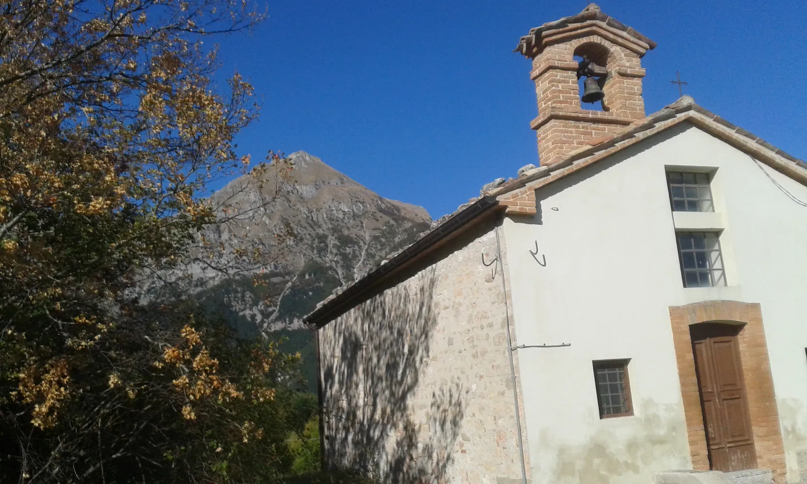
Rubbiano is a hamlet of Montefortino, in the province of Fermo, at 779 meters on the Marche side of the Sibillini Mountains. In dialect the village is called "Lu Fià". The houses sit on a rocky plateau on the right bank of the Tenna river, at the foot of Monte Zampa, the eastern spur of Monte Sibilla. On this side the mountain rises in a broad grassy slope of pastures and cultivated fields. Farther north the meadows end against the rock walls that herald the Gola dell'Infernaccio, a deep gorge.
Hikers in the Sibillini know Rubbiano mainly as a starting point. The only road from Montefortino to the Gola dell'Infernaccio and the Eremo di San Leonardo hermitage runs through the village. From here you can also reach Monte Sibilla and Monte Priora and, once the trail reopens, the springs of the Tenna at Capotenna, and the village is a stage stop on the Grande Anello dei Sibillini. Rubbiano still bears the marks of the 2016 earthquake, which hit the hamlet hard. After the quake many buildings were shored up and some residents were still waiting to return to their damaged homes.
On the map
Points from the site database. Map © OpenStreetMap contributors · Protomaps.
What to see in Rubbiano
In Rubbiano the interest lies in three things: the church of Santa Croce, the traces of shepherd life on the slopes above the village, and the stories tied to avalanches and to the fairies of the Sibilla.
The church of Santa Croce stands just below the village, along the trail to Vetice. The current building dates from the 18th century. The older church stood higher up, on the mountainside, and was abandoned because it was too far from the village. In 1728 the parish priest of Montefortino, Marco Antonio Nardi, noted that the church had two doors and that mass was said there every feast day. The September 1997 earthquake badly damaged it. Consolidation work in 2002 allowed it to come through the 2016 earthquake intact.
Above the village lie the Valleria and Pian d'Acera (Piannàcera in dialect), an area of meadows and woods. Here remain ruins of farmhouses, livestock shelters, old watering troughs and stretches of dry-stone walls along trails now overgrown by the forest. At Pian d'Acera is the spring that feeds Rubbiano's aqueduct. Two places in particular tell the story of this past:
- Fonte Palù, recently renamed "Cengia del Cinghiale" (Wild Boar Ledge) by hikers: a natural balcony on the rocky slopes of the Sibilla, high above the Gola dell'Infernaccio, where a sheep shelter was built;
- Fonte Bella, also called Fonte di Costa Palù: it is hidden in the woods and today can only be reached by pushing through dense vegetation, with no marked trail.
Behind the village opens a wide valley that IGM maps call Fosso delle Valanghe (Avalanche Gully). In 1933 an avalanche that came down from here killed 13 residents of Rubbiano. After the tragedy, avalanche barriers were installed near the summit of Monte Zampa. According to oral tradition, the dialect name also comes from "fugghià", meaning to flee: it recalls the escapes that winter avalanches forced on the residents. There are other theories too. A 19th-century map calls the village "Fiano", a name that may come from the Latin fanum, sacred place. Others link "Rubbiano" to ruber, red, for the color of the local limestone. Locals also say that the original settlement stood higher up, on the wooded knoll at Santa Croce, now known as Casa Liberati.
The name Valleria comes from the "valli", the dances that, according to folk tales, the fairies of the Sibilla danced with the shepherds. Legend has it that the fairies came down on full-moon nights to dance the saltarello. According to one interpretation, the fairies were Celtic women left without their warriors after the battle of Sentinum in 293 BC, who took refuge in the hills of Le Marche. The link between Rubbiano and the gorge, on the other hand, is recent: until 1820 the Gola dell'Infernaccio could not be reached from the Valleria, and the old road to San Leonardo went through Vetice.
For the main village and the other places in the municipality, see the page things to do in Montefortino.
Nature and trails near Rubbiano
Three routes start from Rubbiano: the Gola dell'Infernaccio with the Eremo di San Leonardo, the Sentiero Natura N5 and the stages of the Grande Anello dei Sibillini.
Gola dell'Infernaccio and Eremo di San Leonardo
- Start: Valleria parking lot, at about 900 m. It is reached by driving past the village, with about 2 km of narrow dirt road to be taken slowly. Along the road there is a spring for filling water bottles.
- Route: from the parking lot, about 800 meters lead to the entrance of the gorge, at the small waterfalls of the Pisciarelle. The trail then runs between the rock walls carved by the Tenna between Monte Priora and Monte Sibilla. At a fork, a path climbs to the Eremo di San Leonardo, at 1,128 m.
- Data: about 7-8 km round trip, elevation gain of about 300-350 m, about three hours. The trail is not suitable for strollers.
- Season: when the regional Protezione civile issues a weather alert, including for avalanche risk, ordinance no. 57 of July 15, 2021 of the Comune di Montefortino bans access to trail E9. The route is usually open from early May through the end of autumn. The trail is heavily shaded and in summer can also be done in the afternoon.
- Recent status: in winter 2026 three avalanches, released from the Montefortino side of Monte Sibilla, fell between the parking lot and the entrance of the gorge, which remained closed by ordinance. With ordinance no. 32 of July 17, 2026, the Comune di Montefortino reopened trail E9 from the Valleria parking lot to the second fork for the Eremo di San Leonardo. A certified mountaineering helmet is mandatory on this section. The section from the second fork to Arcofù, toward Capotenna, remains closed to vehicles and pedestrians. Before setting out, check the ordinances in force.
- Parking: spaces are few and fill up quickly on summer weekends and public holidays, so arriving early is advisable. At the entrance to the hamlet there is a signposted parking lot.
Sentiero Natura N5 (the Montefortino Nature Trail): a loop of about 8.3 km starting from Rubbiano. It is graded easy (tourist grade) and takes about three hours. It passes through maples, beeches and smoke trees and opens into clearings with views of the Sibillini.
Grande Anello dei Sibillini (GAS): a route of about 124 km around the whole range. The fifth stage arrives in Rubbiano, coming from Isola San Biagio via Altino and the Fonte Santa. The sixth stage starts here, toward Colle di Montegallo, crossing the Gola dell'Infernaccio. For a short walk, there is the section from Rubbiano toward Isola San Biagio:
- the trail starts at the entrance to the village, marked by a wooden post with the letter "G";
- it is about 6.5 km round trip, between 800 and 950 m of altitude, in about 2 and a half hours;
- the route is easy and can be walked all year round;
- on clear days the view reaches the Adriatic Sea;
- there are no water points along the way.
For experienced hikers there is also a demanding route from Rubbiano through the gorge up to the summit of Monte Sibilla, at 2,173 m. In winter the area is suited to cross-country skiing and ski touring.
Where to stay in Rubbiano
The only place to stay in Rubbiano is the refuge that serves as a stage stop on the Grande Anello dei Sibillini. It was created by restoring an old rural building owned by the Comune di Montefortino. It has three rooms with a total of 12 beds and is designed mainly for those walking the GAS or setting off early for the Gola dell'Infernaccio. It is best to check availability before leaving. For other types of accommodation, see the page where to stay in Montefortino.
Where to eat in Rubbiano
In Rubbiano meals are served at the refuge, which offers food as well as lodging. Lunch and dinner are by reservation only. For those coming down from the gorge without a reservation, the other options are elsewhere in the municipality: the list is on the page Montefortino restaurants.
Local food in Rubbiano
Rubbiano is a rural hamlet that has always lived from farming and sheep herding. The reference cuisine is that of the Montefortino area:
- meats such as wild boar and Sibillini lamb;
- cucciole, mountain snails cooked with wild fennel and tomato or shelled and served with potatoes;
- black and white truffle;
- mushrooms: porcini, russula and field mushrooms;
- the mela rossa (red apple), one of the most specialized crops in the area.
In Montefortino the cucciole have a food festival (sagra) in September, while in August there is the strozzapreti festival.
Weather and how to get to Rubbiano
Rubbiano is at 779 meters and in winter is exposed to avalanches. The village lies at the foot of the Fosso delle Valanghe, and in 2026 too avalanches cut off the Gola dell'Infernaccio trail.
By car:
- from the A14 highway, take the Civitanova Marche or Pedaso exit and head toward Amandola; alternatively, from Ascoli Piceno take the SP 237;
- follow the SP 83 to Montefortino;
- take the SP 148 following signs for Rubbiano and the Gola dell'Infernaccio.
The road is paved and easy as far as Rubbiano. Beyond the village it becomes a dirt road, rough in places. By train, the closest stations to Montefortino are Porto San Giorgio and Pedaso. For Montefortino and its other hamlets, see the page Montefortino: what to see and do.