


Montefortino: what to see and do
At a glance
- Municipality
- Montefortino
- Province
- Fermo
- Region
- Le Marche
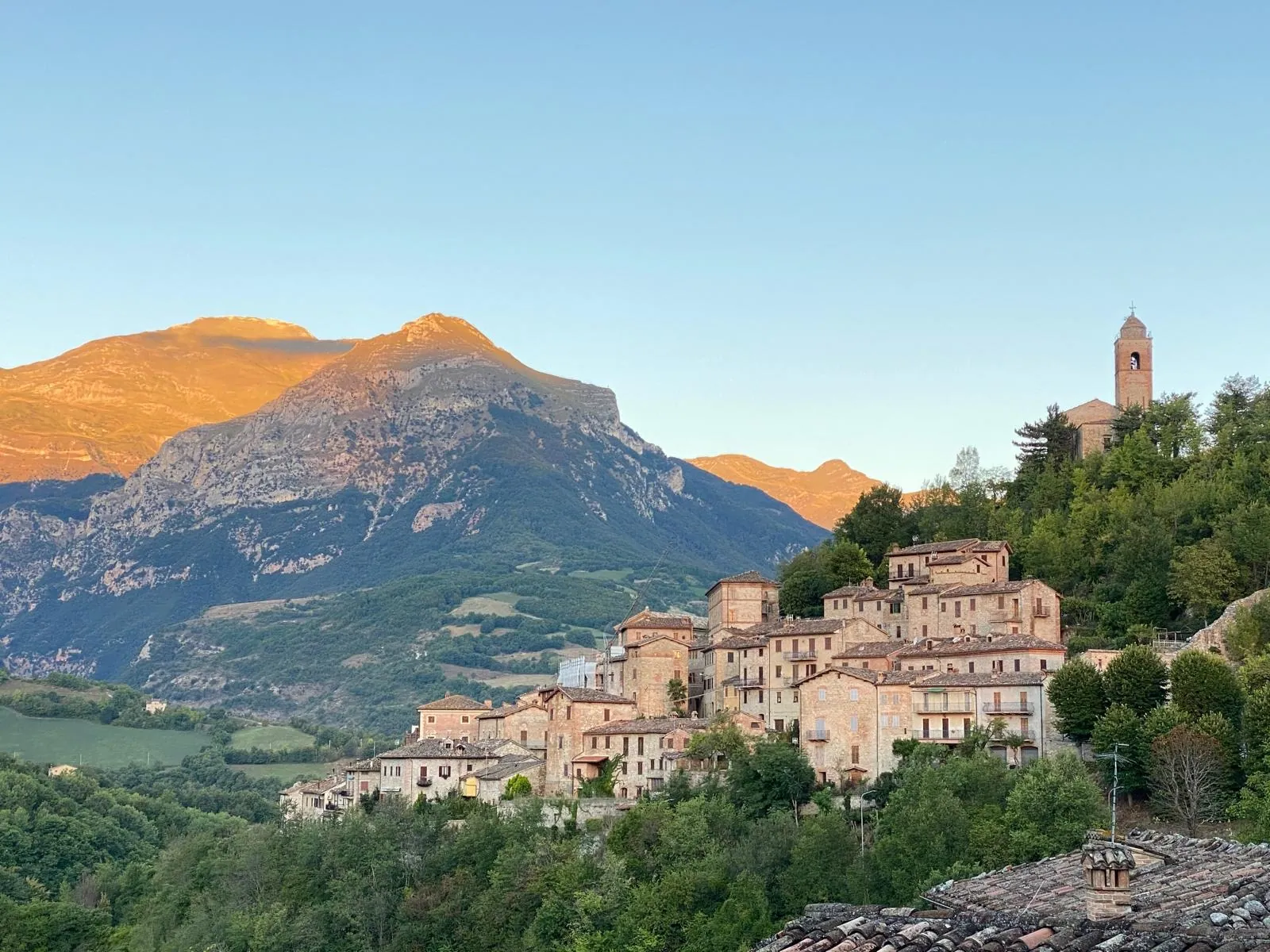
Montefortino is a village in the province of Fermo, in the Marche. Its houses descend the southwestern slope of a hill on the right bank of the Tenna river, at the foot of the Sibillini Mountains. From the stone and brick houses an amphitheater of peaks can be seen: Monte Vettore to the south, then Monte Sibilla and Monte Priora, all over 2,000 meters, as far as Monte Amandola and, farther north, the Pizzo di Meta. The village of Montefortino stands at over 600 meters above sea level. With about 1,010 inhabitants, Montefortino is the second-largest municipality in the province by area, after the provincial capital.
The history of the place begins with Augustus, when the territory was divided and assigned to Roman soldiers at the end of their service. Place names such as Colmartese and Campo d'Arte still recall the cult of Mars. In the Middle Ages Montefortino became a fortified village and a free commune, with its own statute. Today the village bears the marks of the 2016 earthquake, but it keeps one of the most important art collections in inland Marche. Its territory also includes the Sanctuary of Madonna dell'Ambro and the Gole dell'Infernaccio gorge.
On the map
Points from the site database. Map © OpenStreetMap contributors · Protomaps.
What to see in Montefortino
The main sights in Montefortino are the medieval historic center, the Pinacoteca civica Fortunato Duranti art gallery in Palazzo Leopardi and, outside the village, the Santuario della Madonna dell'Ambro. The full list of places is on the page things to do in Montefortino.
Three gates survive from the old walls: the porta di Santa Lucia, the porta San Biagio (known as Portarella) and the porta di Valle (or di Vetice). From here the lanes climb to piazza Re Umberto I, which offers a wide view of the Sibillini Mountains. In the highest part of the village stands, since the mid-16th century, the church of San Francesco, built on the remains of the old church of Santa Maria del Girone. In its place there was once the fortress where the lords who ruled the village at various times lived: in 1442 the inhabitants themselves tore it down, together with most of the walls. The center is completed by the church of Sant'Agostino (12th century), of which part of the convent portico remains, the parish church of San Michele Arcangelo and the Tempietto dell'Orologio, a neoclassical building topped by a 15th-century tower. The facade of the Tempietto was designed by the painter Fortunato Duranti, who lived there in the last years of his life.
The 2016 earthquakes damaged the churches of the center. For this reason, since July 2019, the deconsecrated church of Sant'Andrea, near the Porta di Valle and now used as a conference center, also hosts religious services.
Palazzo Leopardi is a 16th-century palazzo that houses the Pinacoteca named after Fortunato Duranti. The painter and collector, who died in 1863, donated his collection to the municipality. The most important works include a tondo by Perugino with the Christ of the Passion, the Saint Catherine by Antoniazzo Romano, three panels by Pietro Alemanno and a 15th-century Venetian cross. The collection has about 150 works including paintings, sculptures, applied arts and drawings, so much so that the Pinacoteca is called the "little Louvre" of the Sibillini. The same palazzo houses the Museo d'Arte sacra (sacred art museum), opened in 2000 with the diocese of Fermo, and the Museo faunistico dei Sibillini (wildlife museum). After the earthquake the complex stayed closed for a long time: in 2025 the Pinacoteca reopened on an exceptional basis, after about a decade, for the FAI Spring Days (Giornate FAI di Primavera). Before setting out, check whether it is open.
The Santuario della Madonna dell'Ambro is in the valley of the Ambro stream. The first church was built around the 11th century, according to tradition after the Madonna appeared to a shepherd girl, deaf and mute from birth, who regained her speech. In the Marche it is the most important Marian shrine after Loreto. The 2016 earthquake damaged it and the church was declared unsafe; after the work it reopened for worship on December 25, 2018. The convent has also been restored, and since 2021 the sanctuary has been fully operational again.
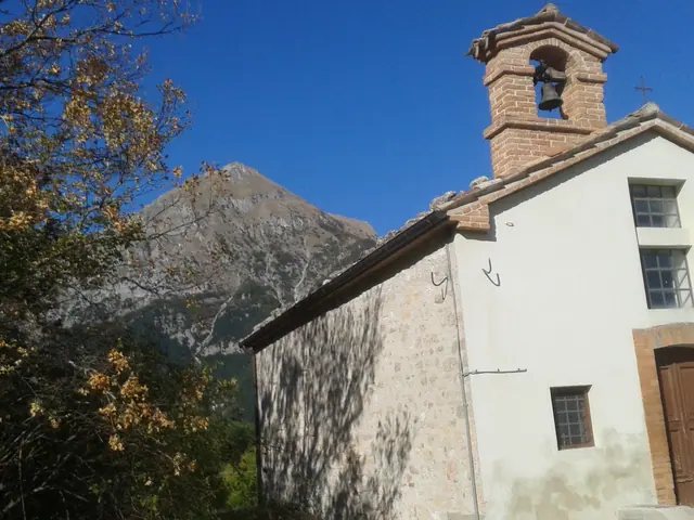
On a hill between the Cossudro and Vetremastro streams stands the church of Sant'Angelo in Montespino. Its origins go back to the 6th century, in the time of the Lombards, and it reached its present form in 1604. It is reached from the hamlet of Cerretana: the dirt road is not comfortable but can be driven, and from the hill the view sweeps from the Sibillini to the Monti della Laga and the Adriatic coast.
Nature and trails near Montefortino
The best-known hike in the area is the Gole dell'Infernaccio gorge. Before setting out, however, there is something to know: with ordinance no. 32 of July 17, 2026 the Comune reopened the E9 trail from the Valleria parking lot up to the second fork for the Eremo di San Leonardo, with a mountain helmet required, while the following stretch, toward Arcofù and Capotenna, remains closed. The 2026 closure was due to the exceptional avalanches of the winter, which left many dangerous obstacles along the route; the stretch toward Arcofù, on the other hand, remains closed under ordinances no. 30 and no. 44 of 2020.
In the gorge, the Tenna cuts through the rocks of Monte Priora and Monte Sibilla between steep walls. Up high, on a plateau above the gorge, stands the Hermitage of San Leonardo al Volubrio, a hermitage. The hermitage was also damaged by the earthquake, and it is best to check before visiting whether it is possible to go inside; from there the view opens onto the steep north face of Monte Sibilla. When the trail is open, it starts from the Valleria parking lot, in Rubbiano, a hamlet of Montefortino. The route is about 7 km round trip, with about 300 meters of elevation gain and a tourist-hiking difficulty grade (T/E). It passes the small waterfalls called "Pisciarelle" and the gorge carved by the Tenna, up to the San Leonardo beech wood.
As for the season, the route is usually open from early May through the end of autumn. Being well shaded, it can be walked in the morning or afternoon, even in summer.
Higher up, at the springs of the Tenna, lies the pasture of Capotenna, also called Prati di Sant'Antonio. The name comes from an old hermitage dedicated to the saint, where according to tradition the Guerin Meschino also passed on his way up to the Grotta della Sibilla. From Capotenna a glacial valley climbs toward Passo Cattivo. The Ambro stream also carves its own gorge between Monte Priora and Monte Amandola: because of its resemblance to the Tenna gorge it is called Infernaccetto. At the southern end of the municipality, the hamlet of Arato touches part of Lago di Gerosa.
Where to stay in Montefortino
Montefortino has accommodation for different needs: a campground, agriturismi (farm stays), bed and breakfasts and a mountain hut in Rubbiano. In the small rural hamlet of Collina there is also a scattered-hospitality option. For hikers, Rubbiano is convenient because it is already on the road to the gorge. The village, on the other hand, is better suited to visiting the historic center and the sanctuary. The list of places is on the page where to stay in Montefortino.
Where to eat in Montefortino
Food is served in the restaurants of Montefortino and its hamlets. Traditional cooking offers wild boar, lamb, cucciole di montagna (mountain snails) and truffles. The village devotes a festival to cucciole, the snails, held in September. The places to eat are listed on the page Montefortino restaurants.
Local products of Montefortino
The product most linked to the village is cucciole. They are mountain snails with their shells, cooked with wild fennel and tomato or shelled with potatoes. After gathering they are carefully purged for 15-20 days.
The undergrowth provides truffles, both black and white, and mushrooms: porcini, russula and field mushrooms. Truffle gathering has been documented since the 16th century, while farming has specialized in a few products, such as the red apple. Among the honeys of the Sibillini, the high-mountain wildflower honey and chestnut honey are especially prized. Gorbini are a wild herb similar to spinach that grows between 1,000 and 1,800 meters.
At the locality of Tre Ponti, where the Tenna receives the Ambro and the Cossudro, mineral water sold under the name "Tinnea" was once drawn.
Weather and how to get to Montefortino
To get to Montefortino a car is practically necessary, and the last stretch is on the SP 83. From the north, exit the A14 at Civitanova Marche and take the SS 77 expressway toward Tolentino/Macerata. Exit at Macerata Ovest/Sforzacosta, follow the SP 78 through Sarnano and Amandola and finally take the SP 83 to Montefortino. From the south, follow the A14 toward San Benedetto del Tronto/Ascoli Piceno, then the RA11 and the SS 4, through Roccafluvione and Bussonico, up to the SP 83. From Rome, take the Salaria to Mozzano and then the SS 78 for Comunanza and Montefortino. Amandola is 6.2 km away along the SP 83.
By train, the stations on the Adriatic coast, such as Porto San Giorgio, Pedaso or San Benedetto del Tronto, or Ascoli Piceno can be reached, continuing from there by car. The nearest airports are Ancona (110 km), Perugia (117 km) and Pescara (130 km).
Mountain weather has a strong effect on the visit. During weather alerts, including for avalanche risk, access to the gorge is prohibited by municipal ordinance. Before setting out, the municipality recommends checking the website of the Protezione Civile (civil protection) of the Marche Region. The historic center, the Pinacoteca (if open) and the sanctuary can be visited in any season.
In this section
4 results
 Things to Do in Montefortino20 places
 Where to Stay in Montefortino16 places to stay
 Where to Eat in Montefortino8 places
 Rubbiano (Montefortino)Le Marche · Fermo
No results with these filters.