


Grande Anello dei Sibillini Stage 1: Visso to Cupi
Trail facts
- Start
- Visso · 616 m
- Finish
- Cupi · 983 m
- Route
- one way
- Trail marker
- GAS
- Municipality
- Pieve Torina
Grande Anello dei Sibillini Stage 1 links Visso to Cupi, in the municipality of Visso, and opens the trek of nine stages and about 124 km that circles the Sibillini range. The stage is 12.1 km long and climbs about 800 m, passing from the wooded slopes of Monte Careschio to the pastures of the Macereto plateau. Visso is the headquarters of the National Park of the Sibillini Mountains, and the route is described clockwise starting right from here. The most rewarding period runs from May to September.
The section is also known as the "via dei pellegrini e dei pastori" (pilgrims' and shepherds' way). It partly retraces the ancient road that linked the Kingdom of Naples to the Chienti valley and Loreto. Along the way the Rocca di San Giovanni, the Macereto sanctuary and the north face of Monte Bove come into view, before the arrival at the small village of Cupi.
- Distance
- 12.92 km
- Elevation gain
- +783 m
- Elevation loss
- −413 m
- Lowest point
- 615 m
- Highest point
- 1,164 m
- Time
- 5 h 5 min (estimate)
From the OpenStreetMap track and the Copernicus DEM profile; time is an estimate.
Before you go
Forecast at the start
- Today10° / 4°0.0 mmCloudy
Forecast by MET Norway, updated automatically · license CC BY 4.0
Rules and orders: Park website. Snow and avalanches: Meteomont bulletin.
Map, profile and GPX
S Start: Visso · 616 m A Finish: Cupi · 983 m
Map and track: © OpenStreetMap contributors (ODbL).
- Ascent
- 783 m
- Descent
- 413 m
- Lowest point
- 615 m
- Highest point
- 1,164 m
Elevations: Copernicus DEM GLO-30 © DLR e.V. 2010-2014 and © Airbus Defence and Space GmbH 2014-2018.
Indicative OpenStreetMap track: check the markers and trail conditions on site.
The route of Grande Anello dei Sibillini Stage 1
The start is in the historic center of Visso. The trail climbs toward the Rocca di San Giovanni and then along the western slope of Monte Careschio, skirting around it. The first section is in the woods. Most of the elevation gain is between Visso and Macereto.
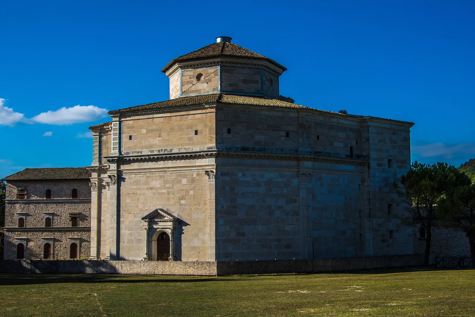
The route then reaches the Piani di Macereto, open meadows and pastures where the sanctuary of the same name, in Bramante style, stands. From here there is a view of the great rock face of Monte Bove Nord. The walk continues around the Fosso La Valle to Cupi, where the view opens to the north, over the Umbria-Marche Apennines. Cupi has the mountain hut where the stage ends.
The Grande Anello can also be walked counterclockwise or starting from another stage point. The next stage, from Cupi to Fiastra, is described on the page Grande Anello dei Sibillini stage 2. An overview of the whole trek is on the Grande Anello dei Sibillini page.
Stage 1 technical data: Grande Anello dei Sibillini
- Start and finish: from Visso to Cupi. It is not a loop: the stage is linear.
- Length: 12.1 km.
- Walking time: about 4 hours and 20 minutes.
- Elevation change: about 800 m of ascent and 432 m of descent.
- Altitudes: the highest point is at about 1,164 m, the lowest at about 615 m.
- Difficulty: the Park classifies the stage as T (tourist). The 800 m of ascent still require good physical fitness.
- Waymarking and management: the Grande Anello is fully waymarked and is managed by the Parco Nazionale dei Monti Sibillini.
- Parking: near the start, in Visso, there are several parking lots. The closest is about 143 m away. A camper van area is about 269 m away.
After the 2016-17 earthquakes the Park had to introduce some detours along the loop, and certain damaged mountain huts have been replaced by temporary structures. It is therefore advisable to check the condition of the route before setting out.
Map of Grande Anello dei Sibillini Stage 1
The official track of the stage, coded "G 01" Visso-Cupi, can be downloaded from the Grande Anello dei Sibillini website. A map with a georeferenced itinerary and a KMZ file are also available on the itinerary page of the Park website. On the ground, the Grande Anello waymarking, described as complete along the whole route, provides orientation.
Points of interest along Grande Anello dei Sibillini Stage 1
Visso. The town has many churches and convents along the initial stretch. Among them are the Collegiate Church of Maria Santissima, the churches of Sant'Agostino, San Francesco, Santa Croce, San Giacomo, the Immacolata Concezione and the Santissimo Crocifisso, and the Convent of the Apostolini. Visso was damaged by the 2016 earthquake: some parts of the town may still be off-limits.
Rocca di San Giovanni. The fortress overlooks Visso from above and is reached in the first part of the climb.
Colle della Torre and Fonte dell'Oppio. They are marked along the climb toward the plateau, together with drinking water points.
Santuario di Macereto. A Renaissance building with an octagonal plan, at an altitude of about 1,000 m. After the 2016 earthquake it remained unusable for a long time and in 2025 restoration work was still under way, but it can be appreciated from the outside as well.
Monte Macereto and Fonte Cordagnolo. They are found on the plateau, before the descent toward Cupi.
Cupi. The small village has the church of the Santissimo Redentore e Santa Maria and the mountain hut where the stage ends.
Frequently asked questions
How long is the first stage of the Grande Anello dei Sibillini and how much does it climb?
Where does the first stage end?
Can the first stage be walked starting from Cupi or in reverse?
Can the Santuario di Macereto be visited?
Nearby
What to see nearby
- Sanctuary of Macereto (Visso)Sanctuary or hermitage1.4 km
- 2.7 km
- 2.9 km
Where to stay
- Rifugio San Benedetto, UssitaBivouac or unstaffed hut1.8 km
- 2.8 km
- 2.8 km
Where to eat
- 2.2 km
- Ristorante Crystal, UssitaRestaurant2.8 km
- Schulzmania, UssitaBar and café3.2 km
Straight-line distances.