


Valle dell'Ambro: how to get there and trails
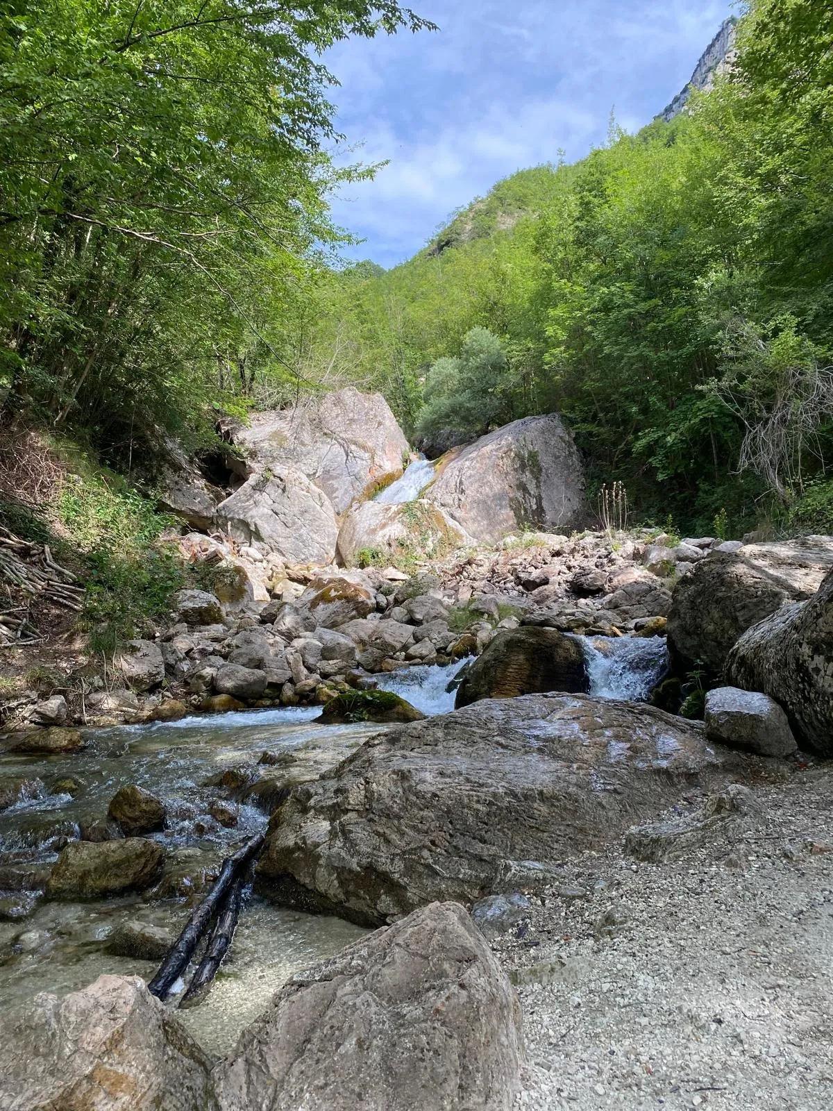
The Valle dell'Ambro is the valley carved by the Ambro stream in the municipality of Montefortino, in the province of Fermo. It lies between Monte Priora and Monte Castel Manardo, within the Sibillini Mountains National Park. The sanctuary of the Madonna dell'Ambro stands at 658 m, and the paved road ends in a large parking area in front of the church. Many trails start from here. The best known lead to the Ambro waterfall and to the source of the stream, on Monte Priora.
The 2016 earthquake left its mark here too. The sanctuary suffered considerable damage and the church was declared unsafe. It reopened on December 25, 2018, after work on the ceiling and the vault. Before setting out it is wise to check the status of roads and services in the area.
Before you go
Forecast
- Today17° / 12°0.0 mmCloudy
- Tomorrow18° / 12°5.2 mmPartly cloudy
- Friday14° / 10°23.3 mmHeavy rain
Forecast by MET Norway, updated automatically · license CC BY 4.0
Rules and orders: Park website. Snow and avalanches: Meteomont bulletin.
On the map
Points from the site database. Map © OpenStreetMap contributors · Protomaps.
Where the Valle dell'Ambro is located
The valley belongs to the territory of Montefortino and is bounded to the south by Monte Priora and Pizzo Berro and to the north by Pizzo Tre Vescovi, Castel Manardo and Monte Amandola. The Ambro stream is a tributary of the Tenna river. Its source is in a small cave on Monte Priora.
The sanctuary is the landmark of the valley floor. It stands on the banks of the stream. Looking north you can see the Balzo Rosso, on the side of Monte Amandola and Castel Manardo. The Balzo Rosso is a wall of Scaglia Rossa rock about 250 m high, dropping almost vertically from the southeastern spurs of Monte Amandola.
How to get to the Valle dell'Ambro
Access is from Montefortino. Just outside the town, toward Amandola, is the junction for the Ambro and the Gola dell'Infernaccio. From there follow the signs for the convent of the Madonna dell'Ambro and drive about 5 km on the provincial road. The sanctuary marks the end of the road, so there is no way to go wrong.
From Macerata take the SS78 to Amandola, where you turn right for Montefortino. From Ascoli Piceno follow the SS4 Salaria to Mozzano, turn off toward Comunanza on the SP 237 and, just before Comunanza, turn left onto the SP105 to Montefortino.
The large parking area at the end of the road fills up fast on weekends in the warm season. For this reason it is best to arrive early in the morning. Montefortino, Amandola, Caldarola and Sarnano are municipalities within the earthquake zone, so it is prudent to check in advance which roads are passable.
Valle dell'Ambro trails and hikes
Ambro waterfall. This is the easiest walk. It starts behind the sanctuary and in about ten minutes leads to a clearing from which the waterfall can be seen. Those who want to go farther can take the trail on the right, which reaches the top of the falls.
Source of the Ambro. This is the valley's classic hike, a loop. From the sanctuary it crosses the bridge and climbs through the woods above 1,000 m, with a steep first stretch. The route is graded E (hiking), follows CAI trail 226 and takes most of the day. From the sanctuary, at 658 m, the route climbs above 1,200 m. The suggested variants are all long and take most of the day. The main spring is a small but distinctive cave. At the start of the route, and often along the way, waymarks are missing. It is therefore best to carry a route track or a map.
Infernaccetto dell'Ambro and Sala del Trono. These are in the stretch of the valley between the Roccacce and the Travertina, about a kilometer downstream of the source. The route starts from the parking area and takes the uphill drovers' track behind the sanctuary (trail 226).
Monte Priora. The trail to the summit of Monte Priora (2,332 m) also starts from the sanctuary. It is a hike for expert hikers (EE), with 1,650 m of elevation gain.
Loop of the hamlets. A loop from the sanctuary takes in Vetice, Capovalle and Piedivalle, along old trails in the foothills. It is described as a hike of medium difficulty, of about 6 hours.
When to go to the Valle dell'Ambro
In summer the valley is well suited to hiking, because the route to the source stays almost entirely in the woods and the heat is barely felt. In summer the streambed can be dry in places. The Infernaccetto has been described with the stream "dry in stretches." In spring and summer the vegetation can be fairly tall along the less-traveled sections.
The trails can be walked in other seasons too: there is a winter hike that shows the valley in a different light. On summer weekends the sanctuary parking area fills up early, so it is best to set off early. Before a long hike it is always good practice to check the weather.
What to see near the Valle dell'Ambro
The first place to visit is the sanctuary, one of the oldest in Le Marche and, after Loreto, one of the most visited. Tradition links it to the apparition of the Madonna to a deaf-mute shepherd girl named Santina, who regained her speech. The earliest record of a church dedicated to the Virgin comes from a parchment of 1073. Inside are paintings depicting the Sibyls.
Montefortino is an old stone village on the slopes of the Sibillini Mountains. Nearby you can visit the Gola dell'Infernaccio. The gorge was carved by the Tenna river between Monte Sibilla and Monte Priora. The trail that follows the stream upriver leads to the Capotenna spring, but since the Gole reopened as far as the second junction for San Leonardo (ordinance of the Municipality of Montefortino no. 32 of July 17, 2026) the stretch toward Capotenna has remained closed: before setting out, check whether it is passable. For that destination there is the page on Capotenna. The Hermitage of San Leonardo al Volubrio hermitage is reached on a hike of a few hours. More routes are gathered on the page on gorges and valleys of the Sibillini.
Frequently asked questions
Where do you park for the Valle dell'Ambro?
Is there an easy walk in the Valle dell'Ambro?
How demanding is the loop to the source of the Ambro?
Was the Ambro sanctuary damaged by the earthquake?
Nearby
What to see nearby
- Fortunato Duranti's House (Montefortino)Historic building or squareunder 100 m
- under 100 m
- Museum of Sacred Art (Montefortino)Museum or art galleryunder 100 m
Where to stay
- 1.1 km
- Bed & Breakfast Cà de La Rossa, MontefortinoB&B or guesthouse2.2 km
- 2.2 km
Where to eat
- Il Chioschetto nel bosco, MontefortinoRestaurant900 m
- Osteria del Nonno, MontefortinoBar and café1000 m
- Il Verdecammino, MontefortinoFarm shop2.1 km
Straight-line distances.