


Montegallo: what to see and do
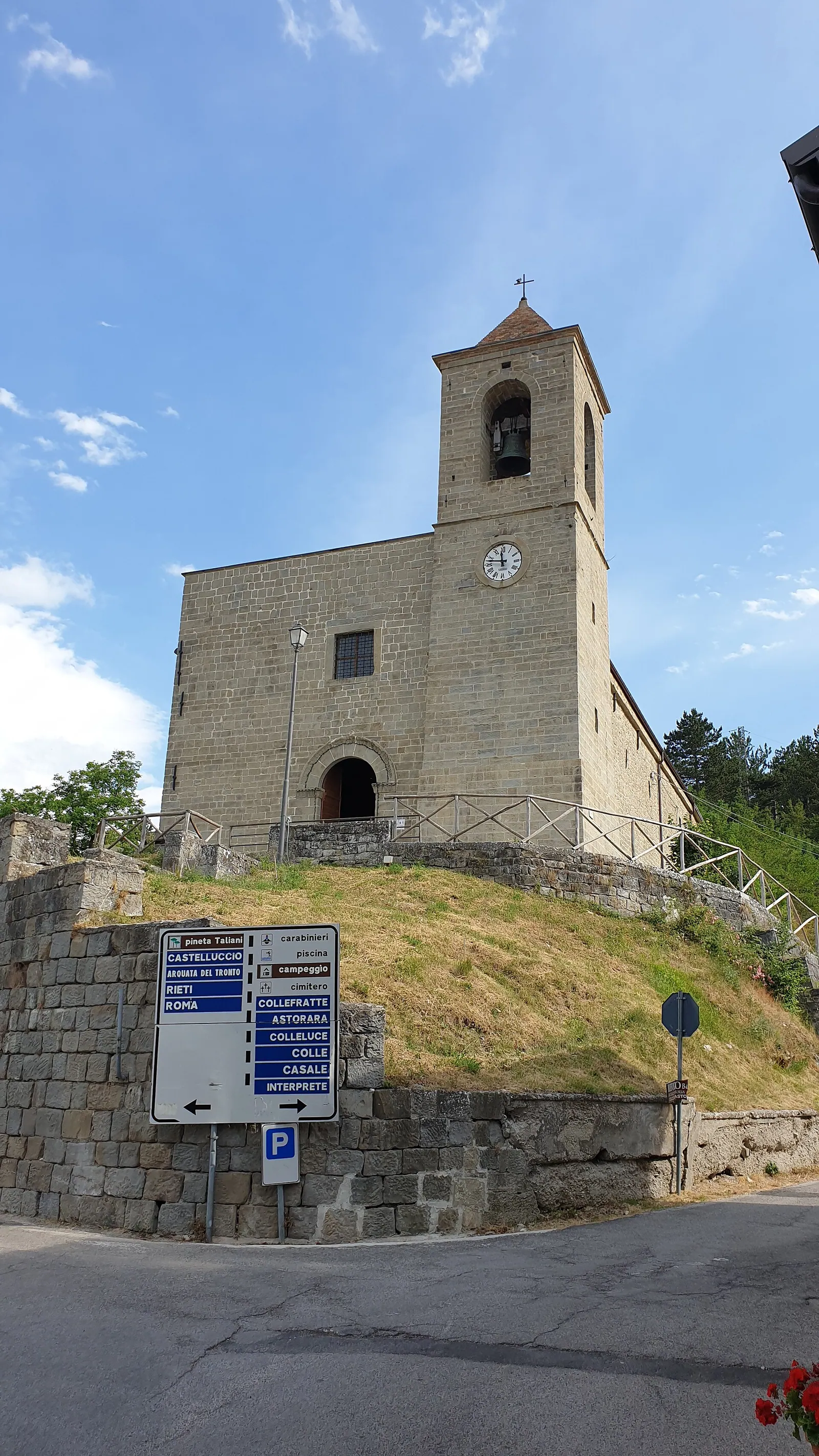
Montegallo is a scattered municipality in the province of Ascoli Piceno, in Le Marche, made up of about twenty hamlets on the eastern side of Monte Vettore. At 2,476 meters, Vettore is the highest peak of the Sibillini Mountains. The Montegallo town hall is in the hamlet of Balzo, and much of the municipal territory lies within Sibillini National Park. The hamlets sit at very different altitudes: Uscerno, toward the hills, is at about 494 meters, while Colleluce reaches 1,023 meters. In between, woods and pastures alternate along the valleys of the Fluvione and Rio streams. Montegallo borders Acquasanta Terme, Arquata del Tronto, Comunanza, Montemonaco and Roccafluvione.
In the Middle Ages the area was called Santa Maria in Lapide, after an ancient church that still dominates the valley. Around the 8th century Marchio Gallo, a vicar of Charlemagne, built a castle on the mountain above present-day Balzo. The castle took the name Mons Sanctae Mariae in Gallo, and from then on the territory began to be called Monte Gallo. In the hamlets there are still buildings in yellow sandstone with decorations from the 15th and 16th centuries. The 2016 earthquake hit Montegallo hard: the October 30 shock made almost the entire municipality unsafe and the population was evacuated to the Adriatic coast. Ten years later, reconstruction is moving forward one building site at a time. Visitors to Montegallo today find hamlets where restored buildings, damaged buildings and rubble stand side by side.
At a glance
- Municipality
- Montegallo
- Province
- Ascoli Piceno
- Region
- Le Marche
On the map
Points from the site database. Map © OpenStreetMap contributors · Protomaps.
What to see in Montegallo
A visit to Montegallo is above all a tour of hamlets, rural churches and views of Vettore. Many historic buildings were damaged by the 2016 earthquake, and the condition of each should be checked before going.
The church of Santa Maria in Lapide is the most important monument in the municipality. It stands in the hamlet of the same name, on the valley floor of the Rio stream. Its origins date back to the 8th-9th century, when the area was controlled by the monks of the abbey of Farfa. The crypt was built in the 9th century. The dome rests on an octagonal drum with a stone gallery, flanked by a bell gable. An inscription in the transept, now illegible, is traditionally linked to 1491, the date of the Renaissance renovation. The church was so important that it gave its name to the whole territory. In 2026 restoration of Santa Maria in Lapide got underway, while in many other hamlets the situation remains difficult.
The church of Santa Maria in Pantano was the other great rural church of Montegallo. It stands above the hamlet of Colle, at 1,159 meters; tradition dates it to the late 8th century, and the first documented records are from 1039. It contained frescoes by Martino Bonfini. Already damaged by the August 24, 2016 shock, it largely collapsed in the October 30, 2016 earthquake; in 2025 the repair work was approved.
The church of San Michele Arcangelo is in the hamlet of Castro, on the left bank of the Fluvione. The current building dates from the 15th century, and a 16th-century date, linked to a major renovation, is carved over its two doors. The earthquake caused very serious collapses, and in August 2026 repair work was underway.
In Balzo, the church of San Bernardino deserves attention. A short walk of about 1 km round trip, between 900 and 950 meters, also starts from Balzo and leads to the ruins of Balzo Vecchia. The small village was inhabited until around 1600. The half-buried outline of the church and a barrel-vaulted water cistern are still visible. From the top there are views of Vettore and the hamlets of Castro, Interprete, Pistrino and Colle. Bisignano, on the other hand, has three churches: the Chiesa Nuova, the church of Santa Maria Maddalena (1578) and the church of the Madonna Addolorata della Cona.
Corbara is a small hamlet built against large tuff boulders. From here a Via Crucis, built in 1951 by the hermit Quintino Sicuro, climbs in 20-25 minutes to the Eremo di San Francesco, an old Franciscan convent. Today the frescoes of Corbara are exposed to the elements and little remains of the hermitage. Fonditore is the birthplace, in 1425, of Blessed Marco da Montegallo, founder of the Monti di Pietà (charitable pawn banks). His birth house lies among the rubble. For more on the monuments, see the page things to do in Montegallo.
Nature and trails near Montegallo
The best-known hike from Montegallo is the climb to Monte Vettore from Colle di Montegallo. It is a loop of about 16.5 km, with about 1,450 meters of elevation gain and a duration of about 8 and a half hours. The difficulty is EE, meaning for experienced hikers. The route passes the church of Santa Maria in Pantano, largely collapsed, and follows trail E15 to the Fonte del Pastore. It then crosses the east-northeast face of Vettore to the ridge with Cima di Pretare and climbs to the summit. The return follows the ridge of Monte Torrone, with exposed sections and unstable scree. This route is not advisable in the hottest months or with wind, snow or ice. After the 2016 earthquake the section of trail E15 remained closed for a long time: before setting out, check its status with the Park authority.
Colle di Montegallo has one of the refuges of the Grande Anello dei Sibillini. The stage from Colle di Montegallo to Colle Le Cese is just under 20 km long, with 650 meters of elevation gain and about 5 hours of walking. It is classified as easy (tourist grade) and runs at the foot of the eastern face of Vettore. Ditches and gullies of glacial origin descend from the ridge, carrying water into the basin of the Fluvione stream, a tributary of the Tronto.
The trail between Fonte Graniera and the source of the Fluvione, near Colleluce, is cut by a large landslide and cannot be walked. Guided hikes and horseback rides are also organized in the area. Before any outing at altitude, check the weather.
Where to stay in Montegallo
The list of places to stay is on the page where to stay in Montegallo. Accommodation is still affected by post-earthquake reconstruction, so it is best to book in advance and check access to the chosen hamlet.
Where to eat in Montegallo
Restaurants and other venues are listed on the page Montegallo restaurants. In the smallest hamlets services are few: for an early start on a hike, it can be useful to bring lunch along.
Local food in Montegallo
Montegallo's local products are above all chestnuts and truffles. Local farming also includes forestry and other organic production. Honey is a local product too, and in the past a food festival (sagra) was dedicated to it in Balzo.
Uscerno has hosted the Sagra della Castagna e del Miele di Castagno, a festival of chestnuts and chestnut honey. The stalls sold honey, saffron, cured meats, cheeses, truffles and vino cotto, a "cooked wine". On the table there were polenta with guanciale and sausage, tagliatelle with porcini mushrooms and truffle, beans with pork rind and various chestnut desserts. The pro loco festivals remain among the main events in the area, but dates and editions should be checked year by year.
Weather and how to get to Montegallo
In winter Montegallo can get heavy snowfall, including blizzards, and the snow easily exceeds one meter. On Monte Vettore the first snow can arrive as early as late September, while in the hamlets it usually does not fall before November. Montegallo can be visited all year round, but hikes at altitude require stable conditions. In winter some trails at the foot of Vettore are not advisable because of avalanche danger.
Montegallo is reached by car from Ascoli Piceno, about 32 km away by road. From the A14 highway, take the San Benedetto del Tronto exit and the connecting road toward Ascoli Piceno, direction Roma. Then follow the Salaria (SS4) and finally the SP237 toward Montegallo, via Roccafluvione and Uscerno. By train, the closest station is Ascoli Piceno, connected to Montegallo by regular bus service. To get from one hamlet to another and reach trailheads such as Colle, a car is needed. For other villages in the area, see the page villages of the Sibillini Mountains.
In this section
3 results
 Things to do in Montegallo9 places
 Where to stay in Montegallo4 places to stay
 Montegallo restaurants4 places
No results with these filters.