


Sibillini Trail Map: Maps and Routes in the Sibillini Mountains
The Sibillini trail map is not a single document. It is a set of tools: the maps and routes of the Sibillini National Park (Monti Sibillini), the 1:25,000 hiking maps and the mountain bike maps. The Park protects the massif between the Marche and Umbria. It covers over 70,000 hectares across four provinces (Ascoli Piceno, Fermo, Macerata and Perugia) and has its headquarters in Visso.
The network ranges from the Sentieri Natura, short nature trails starting from the historic centers, to the Grande Anello dei Sibillini, a fully marked 124 km route. The effects of the 2016-2017 earthquakes are still visible in the area: before choosing an itinerary, it is worth checking which sections are passable.
The trails
6 results
- Grande Anello dei Sibillini9 stages
- TrailCammino nelle Terre MutateArquata del Tronto · Difficulty NON INDICATA · 246.3 km · +9,619 m · 86:50 h
- TrailSentiero Italia CAIDifficulty E · 24.4 km · +962 m · 8:20 h
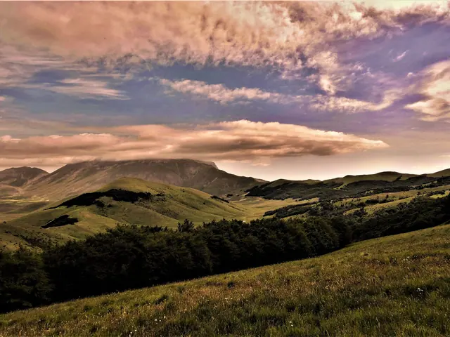 Forca di PrestaMountain pass · Arquata del Tronto
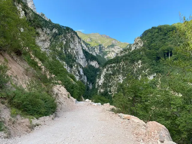 Gola dell'InfernaccioGuide
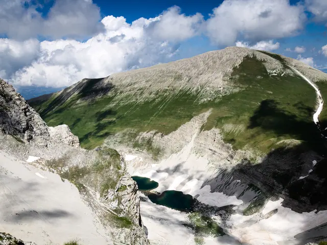 Lago di PilatoLake · Montemonaco
No results with these filters.
On the map
Points from the site database. Map © OpenStreetMap contributors · Protomaps.
Sibillini trail map: the maps
The main reference is the Park's cartography. On the Park authority's website each hiking route has a page with a map, elevation profile, photo gallery and video. Georeferenced maps and downloadable GPS tracks are also available, along with a view on Google Earth. The official trail map is at a scale of 1:40,000. It is aimed at a less demanding tourist audience, while for more detail there are 1:25,000 hiking maps.
Some 1:25,000 maps also mark the long-distance trails: the Sentiero Italia, the Terre Mutate and the Anello dei Sibillini. Another map shows mountain huts and accommodation. For multi-day routes, a good starting point is the page on multi-day hikes in the Sibillini, while the Cammino nelle Terre Mutate main route has its own page.
For anyone looking for the CAI Marche trail map, the key point concerns trails classified as "historic". They appear on the official Park map, but the Park does not guarantee their maintenance or signage. The Park has an agreement with the regional CAI groups of the Marche and Umbria for painted trail blazes and for monitoring trail deterioration. This, however, does not guarantee that the trails are passable or safe for hikers. On the Sentiero Italia CAI, in the Sibillini section, the Park lists three stages:
- Madonna delle Coste - Castelluccio
- Castelluccio - Norcia
- Norcia - Visso
For mountain biking the network is very extensive. It includes several one-day loops and the Grande Anello Bike. Anyone looking for the Sibillini Bike Map will find a website dedicated to MTB itineraries, founded by an MTB guide. Each route sheet gives the start, kilometers, elevation gain, difficulty and best period. The Anello del Fiastrone, for example, starts from Fiastra. It is 37 km long with 1,750 m of elevation gain, is rated medium difficulty and is recommended from May to October. The Alta Val di Panico starts from Ussita. It is 30 km long with 1,300 m of elevation gain, is demanding and is recommended from June to October.
Sibillini trail map: places not to miss
The Lago di Pilato is the best-known destination. It lies at 1,941 m, in the municipality of Montemonaco (province of Ascoli Piceno), in a narrow glacial valley. It is the only natural lake in the Marche and is called "the lake with glasses" because of the shape of its two pools. The classic route starts from Foce di Montemonaco, where you park at the end of the houses. It follows trail 151 across the Piano della Gardosa and climbs the hairpin bends of the "Svolte". The itinerary is about 13 km out and back, with about 1,000 m of elevation gain and about 6 hours of walking. It is graded E, meaning hiking. There are other approaches, for example from Forca di Presta on trail 101 (graded EE) or from the Capanna Ghezzi.
A second setting is the Gola dell'Infernaccio. On the Rubbiano - Casale Rosi itinerary, along the Tenna, the route passes Stretta le Pisciarelle and the Gola dell'Infernaccio as far as Casale Rosi, near Capotenna. The return follows the same route, and it can be done on foot or by bike. With ordinance no. 32 of July 17, 2026, however, the Municipality of Montefortino reopened only the section from the Valleria parking area to the second junction for the Eremo di San Leonardo, with a helmet mandatory: the section from the second junction to Arcofù, toward Capotenna and Casale Rosi, remains closed to vehicles and pedestrians, and before going it is best to check the ordinances in force.
Other routes listed by the Park are "Fra Camosci ed Aquile" ("Among Chamois and Eagles"), from Bolognola to the Fonte dell'Aquila, and the Grande Anello. The latter starts from Visso and is walked in nine days. Cyclists can ride the Grande Anello by mountain bike, which also starts from Visso. It runs clockwise with stops at Fiastra, Amandola, Montegallo and Norcia and is ridden in five stages.
For those short on time or looking for less demanding routes, the Park has 18 Sentieri Natura. Two are "for everyone", meaning they can also be used with strollers or wheelchairs. More options are gathered in easy Sibillini Mountains walks and in loop hikes in the Sibillini. In winter there is snowshoeing in Le Marche.
Sibillini trail map: tips for your visit
The first thing to check is the state of the area. The Park publishes a map with the closure ordinances for roads and trails and the red zones still in place. Some historic centers are partly accessible or closed, also because of reconstruction works. On the Sentieri Natura a green symbol indicates an open route, yellow one that is not fully open or has significant detours, and red a closed route. The Park points out that hiking is possible even in the earthquake-affected areas. The objective risks, however, are greater because of slope instability.
The route pages on the Park website also give the rules of conduct, including those on keeping dogs, and an alert about African swine fever. It is worth reading them before choosing a route, especially when traveling with a dog or by bike.
A paper map is still useful alongside the GPS track. For the Lago di Pilato the climb requires a minimum of physical fitness. The whole hike takes about 6 hours out and back, so it is best to start early and check the weather. For a guided hike, the Park Guides are available. For the Lago di Pilato from Foce, the most suitable period is May to October.