


Hiking GPS navigation: GPS units, maps and compasses
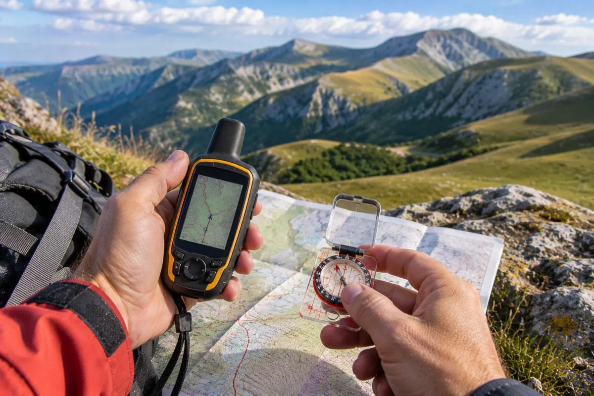
For hiking, GPS navigation tells you where you are and helps you find the route back, and it becomes especially valuable when visibility is poor. It does not, however, replace map, compass and altimeter: for the Guide alpine (Italy's mountain guides) these are the fundamental tools of every outdoor activity and the basis for using a GPS well too. The smartphone, the most common way of navigating, has serious limits precisely in cold and bad weather.
This applies in the Sibillini Mountains too. The National Park warns that not all trails are fully waymarked and that, outside the managed routes, other tracks have no markings at all: anyone walking without an experienced guide must have solid hiking experience.
Hiking GPS and navigation: how to choose
The choice starts from the type of outing: there are many models on the market, and the one suited to your own activities is the one to get. Navigation tools belong to four families, which are not mutually exclusive.
Dedicated handheld GPS. It connects directly to satellites, with an antenna designed for remote and wooded areas. It shows your position, records the route traveled, allows a return to the starting point and measures altitude and distances. It has long-lasting batteries, often replaceable when there is no way to recharge, and it is normally resistant to water, impacts, dust and mud. It requires no service plan: after purchase there are no further running costs. For the Guide alpine, the difference compared with apps shows above all in bad weather, which is when the tool is really needed.
GPS watch. It puts the essential functions on the wrist: position, altitude, progress along the route and the ability to find the way back by retracing your steps. The barometer helps predict incoming thunderstorms.
Smartphone with a navigation app. It may be enough for short outings on well-marked trails, but it is not recommended as the only tool for those who leave the trail. Apps use a lot of power and the battery drains quickly at low temperatures. The touchscreen is hard to read in daylight and cannot be used with winter gloves. Most phones, moreover, are not waterproof and do not withstand impacts, dust and mud. The phone is still useful for calling for help.
Map, compass and altimeter. Map and compass need no batteries, and a compass never loses signal. A map can, however, be out of date, and it has to be read correctly. According to the Guide alpine, these tools should be used routinely and, if anything, supplemented with GPS, not the other way around.
Hiking GPS and navigation: what to look for
Screen and controls. For outings in the cold and at altitude, the Guide alpine recommend models without a touchscreen, with a display readable in any light.
Battery life. A dedicated GPS lasts longer than a phone. It is worth checking whether the batteries can be changed during the hike.
Ruggedness. Waterproofing, resistance to scratches and impacts, protection from dust and mud: these are standard features in a good hiking GPS.
Satellite systems. Manufacturers state that a receiver able to use multiple systems, that is GPS, GLONASS and Galileo, finds the position faster and more precisely.
Maps. On devices that support them, topographic maps at 1:25000 scale can be loaded, on which to follow tracks and routes prepared before setting out.
Tracks and waypoints. The GPS stores tracks and shows their distance, elevation gain and gradient, useful data for planning a hike. Waypoints are points whose latitude, longitude and altitude are saved.
Altimeter. Altitude can come from the satellites or from a barometric sensor, which calculates it from air pressure and a reference value. Since changing weather alters the readings, the reference must be reset regularly, using the altitude of your current location read from a topographic map. An altimeter helps locate yourself on the map using the contour lines and confirm your position when visual references are missing, for example in fog or dense woods.
Satellite messaging. Some devices send a distress call, coordinates and short text messages even where there is no phone line or data network. Unlike a simple GPS they require a service plan; the Guide alpine consider them perhaps even more useful.
Compass. The most versatile type is the baseplate compass: it has a transparent base to place on the map and a rotating capsule graduated from 0 to 360 degrees. More technical models add a sighting mirror, useful for aiming at distant landmarks on open ground and ridges, and a clinometer, which measures slopes.
Map. A map of the area is recommended, preferably at 1:25000 or 1:50000 scale, kept in a waterproof bag. The map of the Sibillini Mountains National Park is at 1:40000 scale: in editions from 2012 onward it shows the historic trails in gray, with a three-digit number.
Hiking GPS and navigation: practical tips
Learn to navigate before buying. For the Guide alpine everything starts from a sense of observation, which is trained by spending time on the ground: the use of map, compass, altimeter and GPS is then built on that basis. Several mountain professionals run navigation courses at various levels.
Plan the route at home. The route should be planned in detail, with a complete route sketch that includes escape routes, and assessed against your own navigation skills. In the Sibillini Mountains it is wise to ask locally whether trails are actually passable: some still bear damage from the 2016 and 2017 earthquakes. In winter and early spring certain routes may be snow-covered or exposed to avalanches.
Do not rely on a single tool. A breakdown, something forgotten or dead batteries leave those who rely only on technology without any reference.
Manage power. Cold reduces the available charge of lithium batteries, and at altitude phone signal is not guaranteed. A power bank for recharging the phone is always useful.
Use the compass properly. It should be held flat and away from phones, keys and metal objects, which distort the reading. Even those who cannot use it precisely can rely on it to hold a direction of travel.
Know what to do if you get lost. The Soccorso Alpino (mountain rescue) teaches a four-step sequence: stop, work out the last certain point, observe the terrain and only then decide. If the situation is dangerous, it is better to call for help than to carry on without knowing where you are.
Be able to give your position. The first question from the single emergency number operator is where you are calling from. Coordinates are needed, along with the trail name, its number if visible, and geographic landmarks. Where there is no data network, the phone's GPS works better in an open area.
To complete the equipment, a good starting point is the mountain hiking gear buying guide, with the guides to the hiking backpack, hiking boots and mountain hiking clothing; for outings on snow there are the dedicated guides to snowshoes and microspikes.