


Amandola: What to See and Do
At a glance
- Municipality
- Amandola
- Province
- Fermo
- Region
- Le Marche
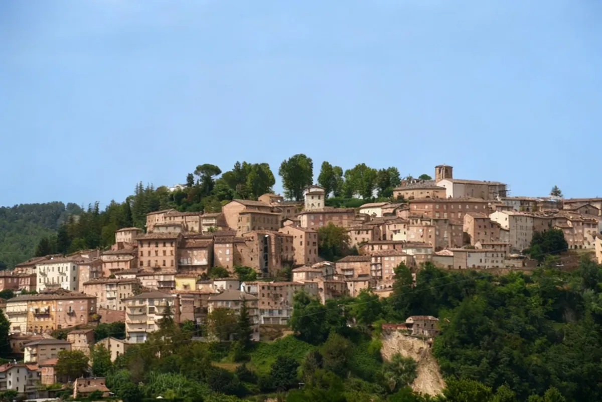
Amandola is a town in the province of Fermo, in the Marche region. It sits on three hills of the upper Tenna valley that still bear the names of the medieval castles it grew from: Agello, Leone and Marrubbione. The highest and most populated is Castel Leone, at about 550 meters above sea level. The free commune (Libero Comune) was born in 1248 from the formal union of the three castles. The name is said to come from a large almond tree, the «mannola» in the Fermo dialect, that, according to legend, grew at the top of Castel Leone. That is why the tree appears in the town's coat of arms together with the three hills.
Amandola is considered the eastern gateway to the Sibillini National Park, in the Sibillini Mountains. To the west the municipal territory is closed off by the mountain range: the summit of Monte Castel Manardo (1,917 m) is about 10 km from the town. To the east the Tenna valley runs down to the shores of Lago di San Ruffino, a lake. It is the most populous municipality in the Sibillini area and includes 48 hamlets, many of them on the slopes of Monte Amandola. The 2016-2017 earthquake damaged many historic buildings and reconstruction is still under way: some monuments in the center, such as the La Fenice Theater, cannot yet be visited.
On the map
Points from the site database. Map © OpenStreetMap contributors · Protomaps.
Things to see in Amandola
The historic center of Amandola keeps the layout of the medieval commune. After the first statutes of 1265, the commune built a 2,230-meter circuit of walls with five gates. Today only Porta San Giacomo survives, altered over time and recognizable by its pointed arch and the clock at the top. Through it you enter the semicircular Piazza Risorgimento. Piazza Alta is home to the Palazzo del Podestà of 1352, with its tower partly rebuilt in 1547.
The former Collegiata, an 18th-century church, houses the Museo del Paesaggio (Landscape Museum): this is the Anthropogeographical Museum, a Park visitor center, moved here after the 2016 earthquake from the cloister of San Francesco. The exhibits cover the flora, fauna, legends, history and folk culture of the Sibillini. One section, the «human landscape», shows how farmers, charcoal burners and shepherds shaped the land over the centuries. Interactive panels make it suitable for children too. In the same building, the municipality, with the support of the Ministry, has set up a permanent storage of artworks recovered from churches damaged by the earthquake, displayed as an exhibition.
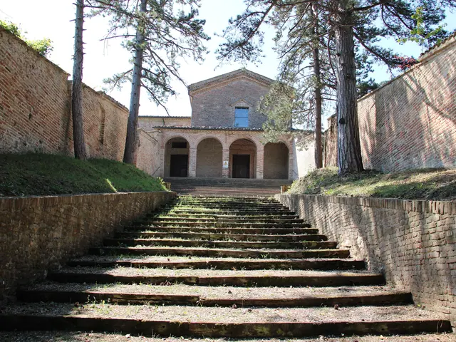
Among the churches, the most significant is Sant'Agostino, the sanctuary of Blessed Antonio Migliorati (1355-1450), the town's patron saint. The church has a Gothic portal of Venetian inspiration and a 15th-century bell tower by Mario Pietro Lombardo. The Romanesque-Gothic church of San Francesco preserves a portal and some frescoes at the base of the bell tower. The adjoining cloister, on two tiers of arcades, has lunettes frescoed in 1635 with scenes from the saint's life. The church of the Santissima Trinità holds the only canvas signed by Pier Simone Fanelli.
The municipal Teatro La Fenice has an elliptical plan, three tiers of boxes and a gallery. The decoration is neoclassical with Art Nouveau (Liberty) elements, the work of Amandola-born Vincenzo Pascucci. Today the theater is unsafe and cannot be visited. On special occasions, such as the Day of the Historic Theaters of the Marche (the first Sunday of October), guided visits have been organized under safe conditions. Over the Tenna stands the Romanesque-Gothic bridge, documented from 1402 and restored in 1435 by master Savino di Stefano Pucci.
Other places are also tied to reconstruction. In 2024 the Monastery of San Lorenzo was returned to the Benedictine nuns. In the summer of 2026 work began on the church of San Pietro Apostolo, badly damaged by the earthquake.
About 10 km from the town, near the Tenna river, stands the Abbazia dei Santi Ruffino e Vitale. It is a Romanesque complex of medieval origin, founded by the Benedictines, with a 13th-century bell tower and late medieval frescoes. Beneath the raised presbytery is a crypt with five small aisles that holds the relics of San Ruffino. The 2016 earthquake damaged it: after repairs it reopened in August 2019.
Amandola also remembers an episode from World War II. In September 1943 the town took in two families of Yugoslav Jewish refugees, who were then hidden in the hamlet of San Cristoforo until the Liberation. For this, stationmaster Giuseppe Brutti and his wife Elvira Lucci Brutti have been recognized as Righteous Among the Nations.
Nature and trails near Amandola
The territory of Amandola ranges from about 400 to about 1,700 meters in altitude. A network of trails starts directly from the hamlets on the slopes of Monte Amandola, such as Garulla, Casalicchio, Casa Coletta and Campolungo.
The Amandola Nature Trail, «Fragili equilibri» (N4), is the easiest route. It is a loop of about 6.2 km at the foot of Monte Amandola, in the Garulla area, graded easy and taking about 3 hours on foot. It crosses woods, hamlets and clearings; it is suitable for everyone, but not for strollers. Garulla Superiore is a few kilometers from Amandola and can be reached by car. It is also a stage of the Grande Anello dei Sibillini, the route of about 124 km in 9 stages that circles the entire mountain range.
Fit hikers can climb to the summit of Monte Amandola from Garulla, at about 880 m. The route follows trail N4 to Casalicchio, climbs to the Rifugio Città di Amandola hut and then to the summit along trail E6. In total it is about 11 km round trip, with 850 m of elevation gain. From the Rifugio Città di Amandola, at 1,182 m, there is also the climb to Monte Castel Manardo: a demanding hike of about 4 and a half to 5 hours. There is also a loop from Campolungo to the top of Monte Amandola. On clear days the Adriatic Sea is visible from up there.
In winter the area offers ski and snowshoe routes. Amandola also lies along the Cammino Francescano della Marca, a Franciscan pilgrimage route. After the earthquake, the Park publishes a map of access restrictions on roads and trails: it is worth checking before setting out.
Where to stay in Amandola
Amandola has been a mountain tourism center for many years, with several places to stay and sports and leisure facilities. Staying in town is convenient for visiting the historic center and the Tenna valley. For those focused mainly on hiking, the mountain hamlets are an option, with mountain huts where trails start right outside. The full list is on the page on where to stay in Amandola.
Where to eat in Amandola
Amandola's cooking revolves around truffles and a few dishes of the farming tradition. The dish most tied to the town is fregnacce: sheets of egg pasta, boiled and rolled up, dressed with meat sauce or with pepper and pecorino. In the richest versions white or black truffle is added, depending on the season. During the feast of Blessed Antonio, 'ngriccio, a typical soup, can be tasted. Other local dishes are crispella and coppa maritata. Amandola also has a long tradition of artisan gelato. Restaurants and trattorias are gathered on the page on Amandola restaurants.
Amandola local products
Amandola's main product is the Sibillini truffle, found year-round. Varieties range from scorzone to the prized black truffle and the white truffle (Tuber magnatum). The calendar follows the seasons. Between late February and March it is the turn of the prized black truffle. In July, the summer black truffle is paired with artisan gelato in a two-day festival. On two weekends between late October and November, the fall edition of «Diamanti a Tavola» takes place, devoted to the prized white truffle; the late-winter edition is devoted to the prized black truffle. The fairs have a market where truffle hunters sell fresh truffles.
The territory of Amandola is also part of the production area of the mela rosa dei Monti Sibillini, a Slow Food Presidium. A typical jam is also made with this apple. Several crafts are still alive in town: woodworking, furniture restoration and antiques, and lacemaking. The shops are on the page on Amandola local products.
Weather and how to get to Amandola
The town is at about 500 meters above sea level, while the trails climb much higher: in the mountains the weather can be very different from that in the town. Before a hike it is best to check the weather and trail conditions, especially in winter.
By car, from the north take the A14 highway and then the SS77 Val di Chienti expressway. Then continue on the SS78 Picena, then on provincial road 78 for about 28 km and on the SP237 for about 8 km. From the south, exit the A14 at San Benedetto del Tronto and head toward Ascoli Piceno on the RA11 link road. Then take the SS4 and finally the SP237, which leads to Amandola. From Rome it is about 204 km by road, or about three hours' drive. From Fermo it takes about 45 minutes. Without a car, a bus line links Amandola to Fermo and to Porto San Giorgio, which has the train station.
Since December 2024 the new Ospedale dei Sibillini (Sibillini Hospital) has been operating in the Pian di Contro area. It is the reference hospital for the mountain area of the southern Marche.
In this section
6 results
- Campolungo (Amandola)Le Marche · Fermo
 Things to Do in Amandola13 places
 Where to Stay in Amandola27 places to stay
 Amandola restaurants12 places
- Garulla (Amandola)Le Marche · Fermo
 Amandola local products and shops7 places
No results with these filters.