


Where Are the Sibillini Mountains?
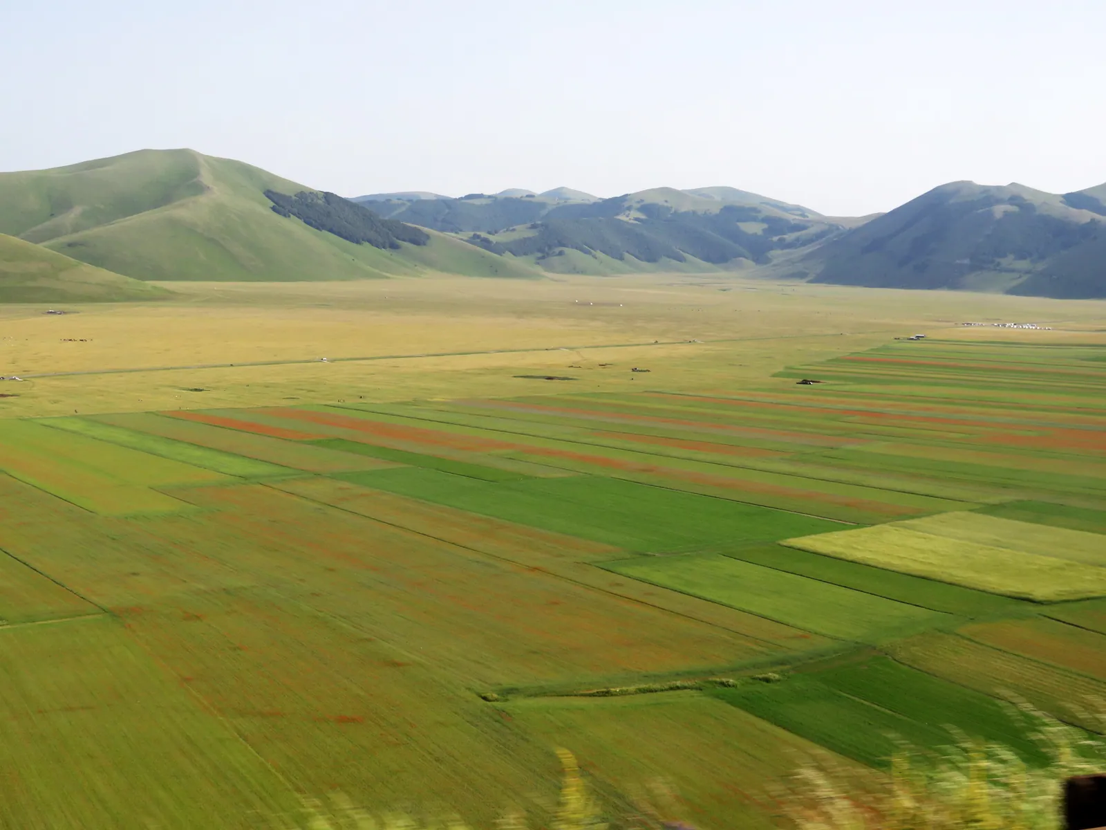
Where are the Sibillini Mountains? They lie in central Italy, straddling Le Marche and Umbria. They are a massif of the Umbria-Marche Apennines that follows the main watershed of the central Apennines and extends across the provinces of Ascoli Piceno, Fermo, Macerata and Perugia. The range runs for about 40 km from north to south and reaches its highest point at Monte Vettore, 2,476 m high. By height it is the fourth mountain group of the continental Apennines, after Gran Sasso, Maiella and Velino-Sirente. The whole area is protected by the National Park of the Sibillini Mountains, established in 1993.
The name comes from Monte Sibilla. Just below its summit was a cave, now blocked, that tradition held to be the home of the Apennine Sibyl. Since the Middle Ages these mountains have been famous as a place of legends, linked to the sorceress Sibyl, to the Valle dell'Infernaccio and to Lago di Pilato. The landscape is made of limestone shaped by Quaternary glaciers: glacial cirques below Monte Vettore and Monte Bove, in the upper Valle dell'Ambro and in Val di Tela, U-shaped valleys lower down and, on the Umbrian side, the Castelluccio plateaus.
Where the Sibillini Mountains are: what to know
The Sibillini massif marks the border between two regions. The eastern side belongs to Le Marche and descends toward the provinces of Macerata, Fermo and Ascoli Piceno. The western side belongs to Umbria and slopes more gently toward the province of Perugia through a series of high-altitude basins: the Piani di Castelluccio.
Sibillini National Park covers about 70,000 hectares and includes 16 municipalities:
- in the province of Macerata: Bolognola, Castelsantangelo sul Nera, Cessapalombo, Fiastra, Pieve Torina, San Ginesio, Ussita, Valfornace and Visso;
- in the province of Ascoli Piceno: Arquata del Tronto, Montegallo and Montemonaco;
- in the province of Fermo: Amandola and Montefortino;
- in the province of Perugia: Norcia and Preci.
The Park Authority has its headquarters in Visso.
The massif has more than twenty peaks above 2,000 meters. The highest is Monte Vettore, in the southern sector; others include the Cima del Redentore, Pizzo del Diavolo, Monte Priora (also called Pizzo della Regina), Pizzo Berro, Monte Porche and Monte Argentella. The Aso, Tenna, Ambro and Nera rivers rise in the Sibillini. Among the park's lakes, two are very different: Lago di Fiastra, a reservoir in the northern sector, and Lago di Pilato, at 1,941 m below the summit of the Vettore.
To decide which side to visit, it helps to think in terms of gateways:
- Amandola, in the province of Fermo, opens up the Marche side with the valleys of the Ambro and the Tenna;
- Arquata del Tronto, in the province of Ascoli Piceno, is the access point for Monte Vettore;
- Norcia, in Umbria, leads to the Pian Grande di Castelluccio;
- Visso, in the province of Macerata, opens up the upper Valnerina and Monte Bove;
- Fiastra is the starting point for the northern sector of the park.
Norcia stands on the Santa Scolastica plateau, on the edge of the Sibillini. Castelluccio di Norcia is a hamlet about 28 km from the main town, at 1,452 m above sea level. The layout of the area is easy to see on the Monti Sibillini map.
Where the Sibillini Mountains are: when to go
The Sibillini Mountains can be visited all year, but each season offers different activities. For hiking, the classic period runs from spring to fall, when the trail network allows visitors to discover both nature and historic sites. Lower down grow woods of downy oak, hop hornbeam and manna ash. Above 1,000 m, beech forests dominate, and from 1,400 m up they are pure beech. Higher still are the high-altitude grasslands, with rare species such as the Apennine edelweiss and the Apennine gentian.
Between late May and mid-July, the Pian Grande di Castelluccio changes color from week to week with the bloom. The most intense moment usually falls in the last week of June, but there is no fixed date: it depends on how the season develops. These are the busiest weeks of the year, and on peak weekends parking and stopping are more strictly regulated, with shuttle services. Those who can should avoid weekends. The full picture, month by month, is on the page the best time to visit the Sibillini Mountains.
Fall is foliage season. In the woods, the yellow of the chestnut trees, which drop their fruit at that time, mixes with the red of the maples and the orange of the beeches. It is also the season of the mele rosa dei Monti Sibillini, an old variety of pink apple rediscovered in recent times.
In winter the highest peaks are covered in snow and the park becomes terrain for ski touring and snowshoeing. Snowshoe outings usually take place between December and March, but only if there is snow: snow cover varies from year to year. Many hiking trails are recommended in winter only without snow and rain. On steep slopes, in gullies and on exposed faces, snow increases the risk of avalanches. More details on the page the Sibillini Mountains in winter.
Where the Sibillini Mountains are: practical tips
By car. The Sibillini Mountains can be reached both from the Adriatic coast and from inland.
- From the A14 highway, the exits are Civitanova Marche to the north, Pedaso and Porto San Giorgio to the east and San Benedetto del Tronto to the south. From there, the routes climb the valleys toward Amandola or Visso.
- From the A1 highway, the exits are Orte or Val di Chiana.
- The main state roads are the SS4 Salaria, the SS77 Val di Chienti, the SS78 Picena and the SS209 Valnerina.
For Castelluccio, the route climbs from Norcia along the SP 477, which descends from the pass into the Pian Grande. Details and alternatives are on the page how to get to the Sibillini Mountains.
By train and bus. The reference train stations are Macerata, Tolentino, Ascoli Piceno and Porto San Giorgio/Fermo in Le Marche, and Foligno and Spoleto in Umbria. From the stations, the journey continues by bus:
- Contram in the province of Macerata;
- Umbria Mobilità in the province of Perugia;
- Start and Steat in the provinces of Ascoli Piceno and Fermo.
Each side has its own lines, so it is best to choose the starting area first.
The effects of the earthquake. The earthquakes of October 26 and 30, 2016, of magnitude up to 6.5, followed those of August 24 and caused serious damage in all the park's municipalities. The hardest-hit villages were Visso, Ussita, Castelsantangelo sul Nera, Castelluccio di Norcia, Norcia and Preci. The consequences of the 2016-2017 earthquakes are still visible. Some historic centers are only partly accessible or completely closed, also because of reconstruction work, and some routes may be banned by ordinances.
Before a hike. It is advisable to check the status of the chosen trail. The Park Authority uses three colors: green for open trails, yellow for those open only in part or with major detours, red for closed ones. Closures can also affect the most popular routes. The Gole dell'Infernaccio, in Montefortino, were closed for months because of damage from winter avalanches and work at the Capotenna spring. With ordinance no. 32 of July 17, 2026 the municipality reopened them as far as the second junction for the Eremo di San Leonardo, with a helmet mandatory; the stretch toward Capotenna remains closed.
Planning the trip. For those who want to see the villages on both sides, there is a Sibillini Mountains road trip through the villages. Before leaving, in every season, it is advisable to check the weather and local roads, especially on mountain roads.